

Having grown up in the South Salish Sea, I spent a lot of time at various anchorages and spots that are still fun to visit. One of my all time favorites is Oro Bay, and I was there earlier this year with some friends and had the opportunity to fly the drone and explore via dinghy.
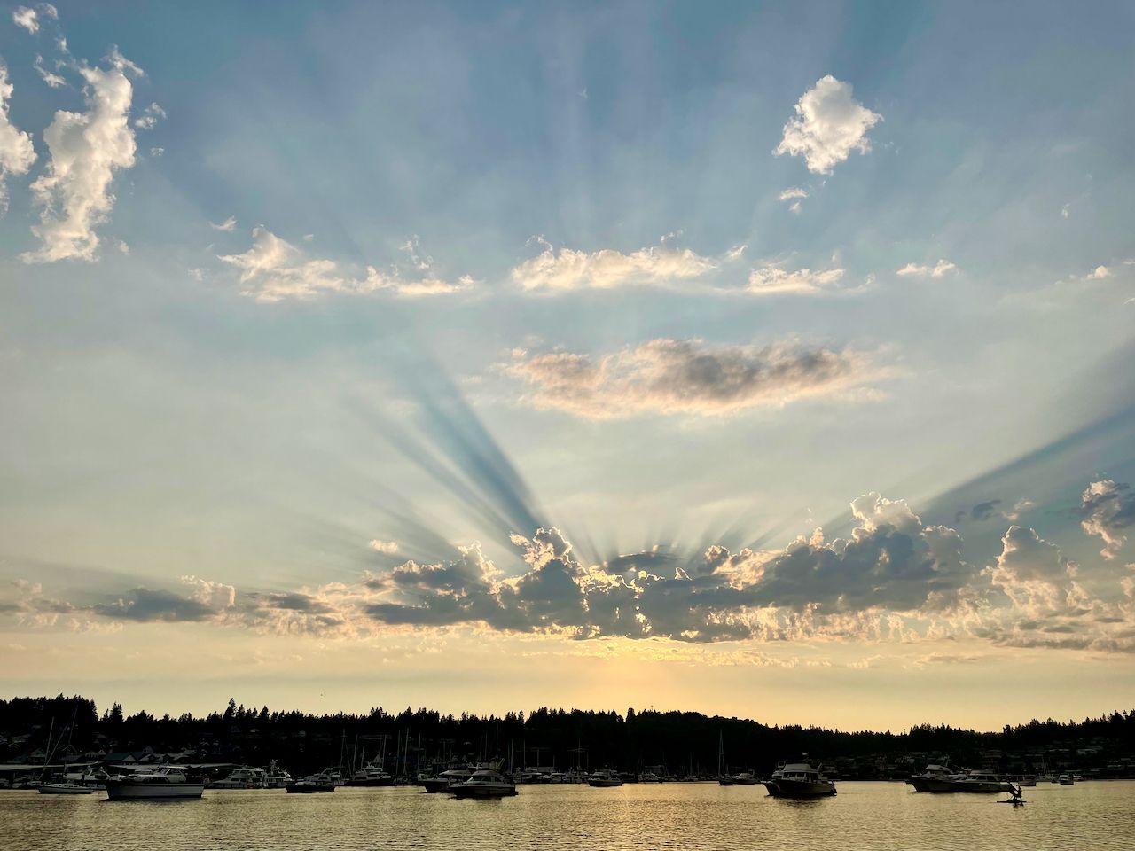
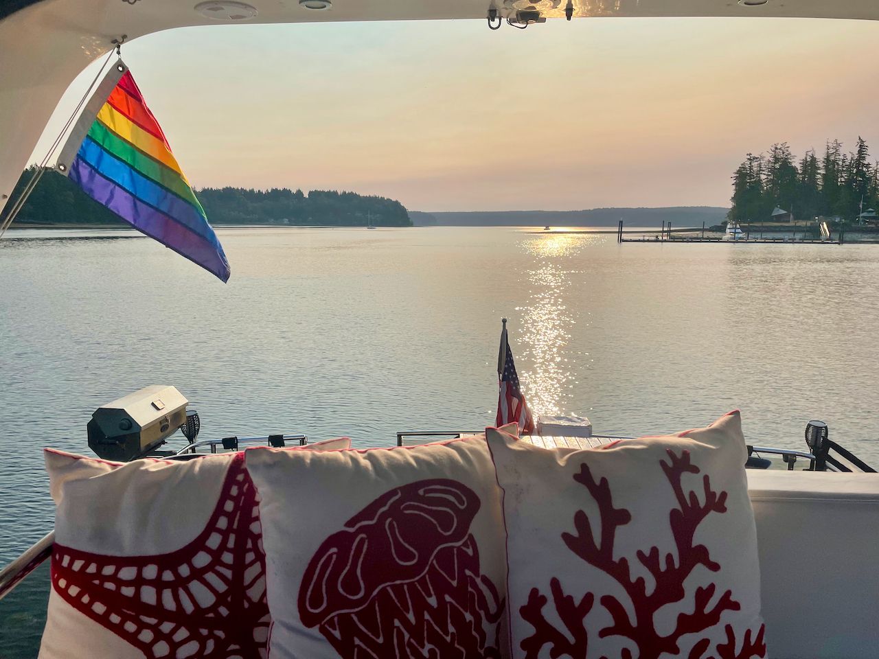
After a nice overnight in my hometown of Gig Harbor, and a beautiful sunset, we headed south towards the Narrows Bridge.
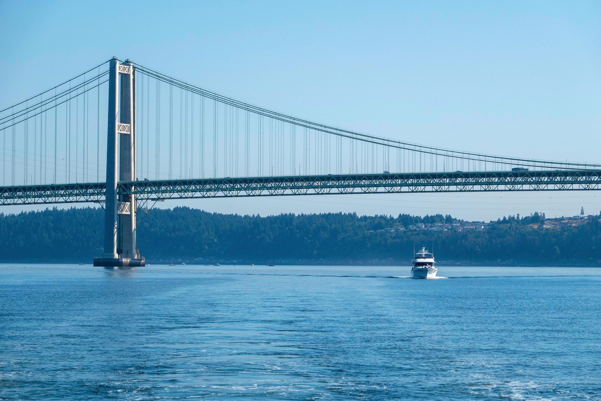
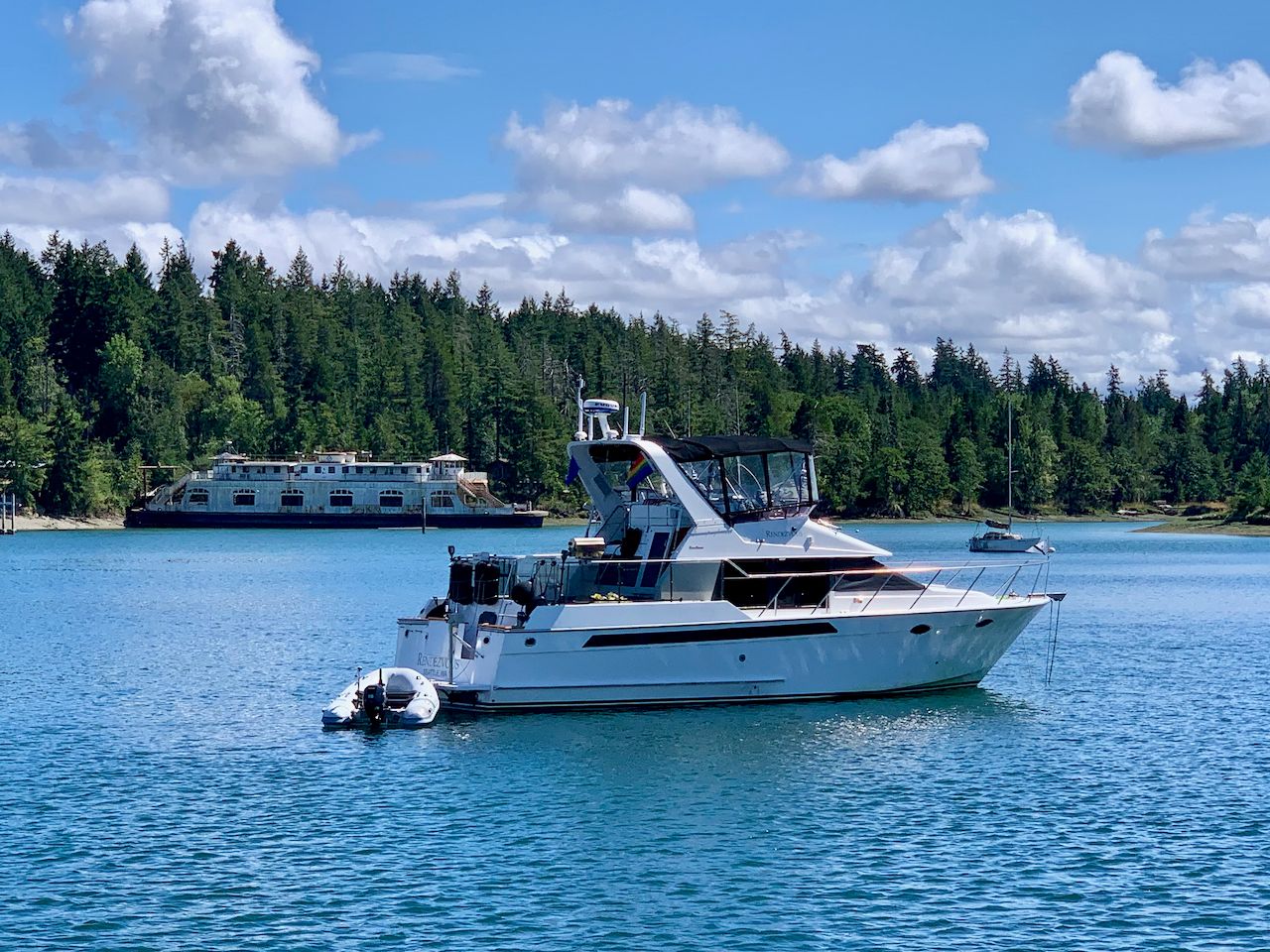
I was cruising with friends on M/V Conundrum on this trip, and always love taking photos of the Narrows Bridge with boats underneath. We had very calm and sunny weather for the majority of our trip.
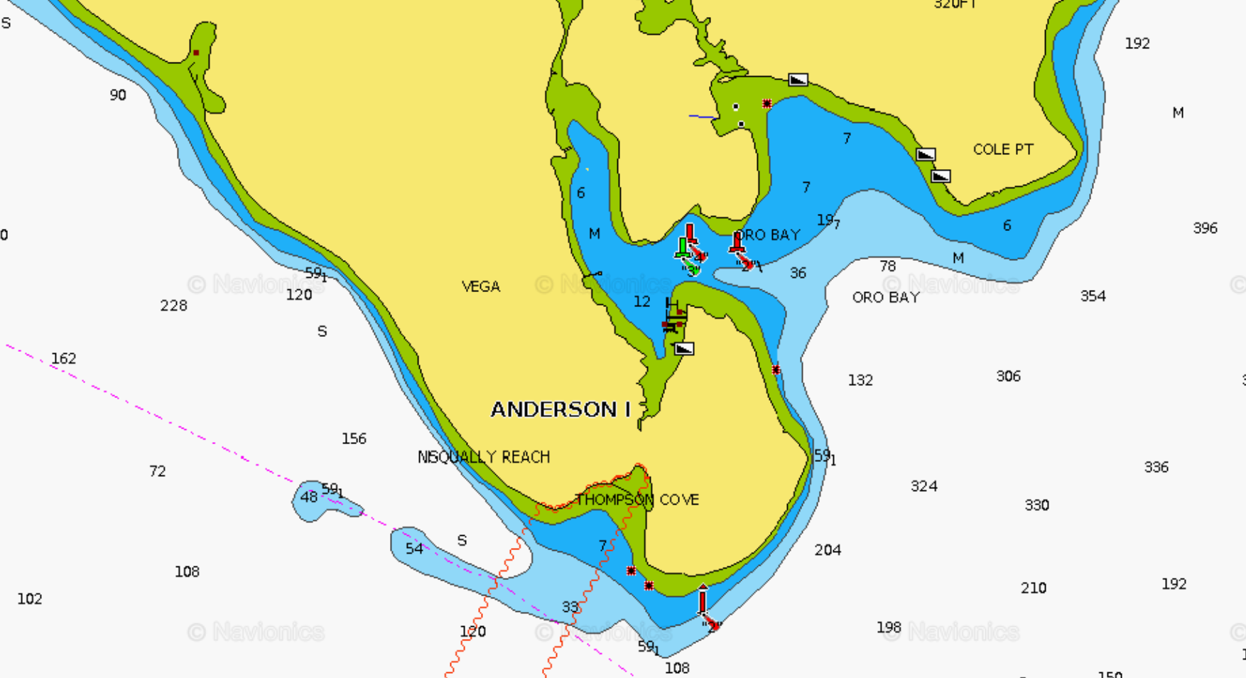
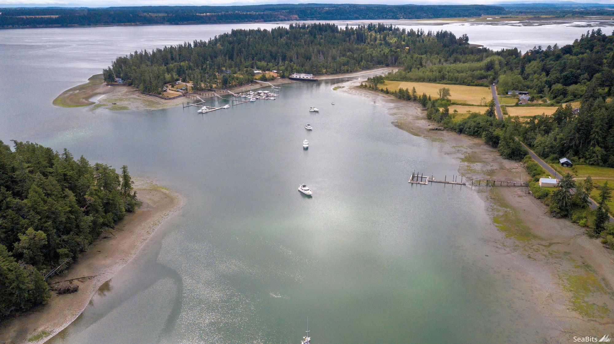
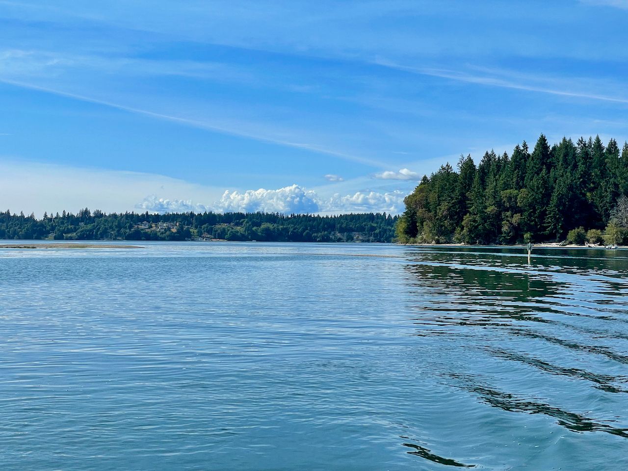
Oro Bay is located on the southern tip of Anderson Island about 14 nautical miles south of Gig Harbor. A lot of charts call both the outer and inner bays by the same name, but there are actually two distinct bays - one less protected one to the east, and the inner one to the west - our goal and spot for the next few days.
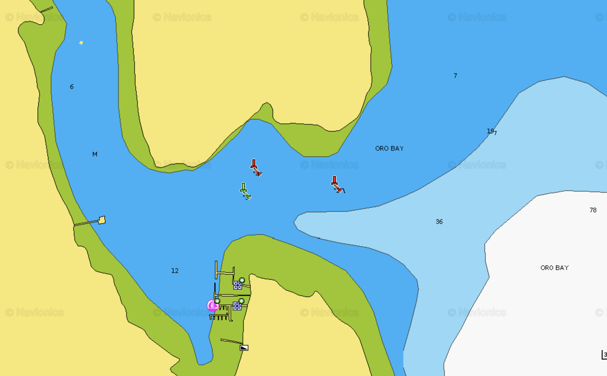
The challenge with Oro Bay is the entrance, which is not that difficult, but can be intimidating if you've never been there before. The charts are also woefully lacking in detail both for the entrance, and the bay itself. What you can see that are important when entering are the three buoys.
A red "2" should be kept well to starboard when entering, and you should pass in between the green "3" and red "4" buoys. It's also generally a good idea to avoid zero and especially minus tides for entering the bay.
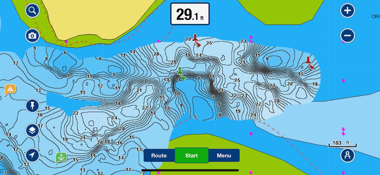
One thing that I've always noticed about the charts here is how inaccurate they are for the entrance as well as the bay inside. Craig off of M/V Conundrum had a neat portable WiFi depth sounder we used to connect to Navionics on our iPhone/iPads so we could get more detailed depth results. I'm sure the folks at anchor thought we were crazy going around and around in lines with the dinghy creating this updated map.
What it does show is that the bottom is quite a bit different than the standard charts for the entrance, with less room near the red "2" buoy, plenty of depth between the other two.
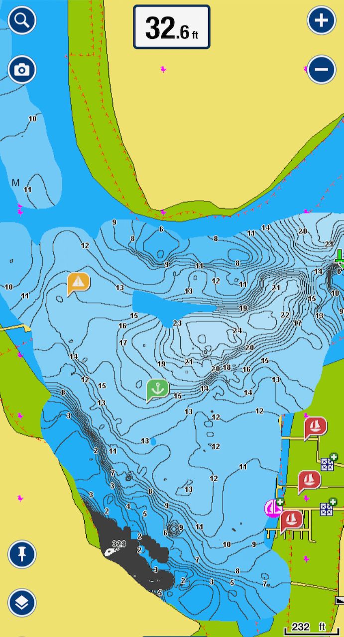
The other nice thing that this shows is how much more room there is in the bay itself. The older charts (scroll up) show the shoreline coming much further out, while the updated depth info shows 10' at zero tide even further in.
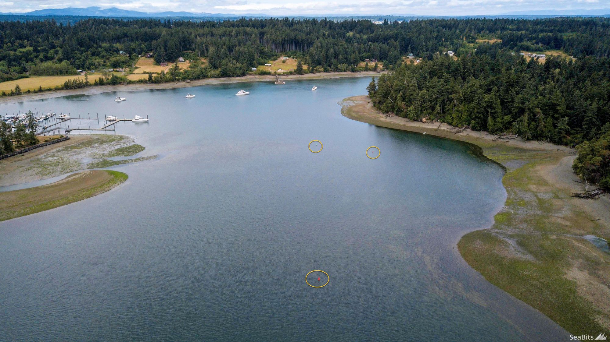
Here's a drone view of the entrance along with the buoys circled. You can see the shallows just to the right of the first buoy.
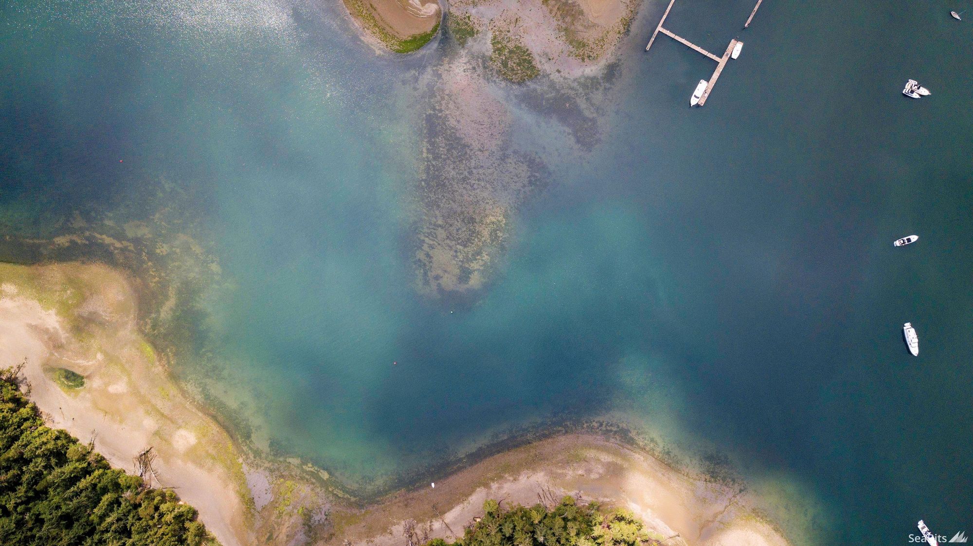
One of my favorite things to do with the drone is to get shots of water and land with the right sunlight, light angle, and water clarity. It provides a spectacular view as to the shoreline, shallows, and contours underwater. Above you can see the first buoy on the left, and then the two inner buoys in about the center of the photo. What's really cool is how clear the shoals are near both sets of buoys.

The shoal to the left of the green "3" buoy is quite easily seen from above.
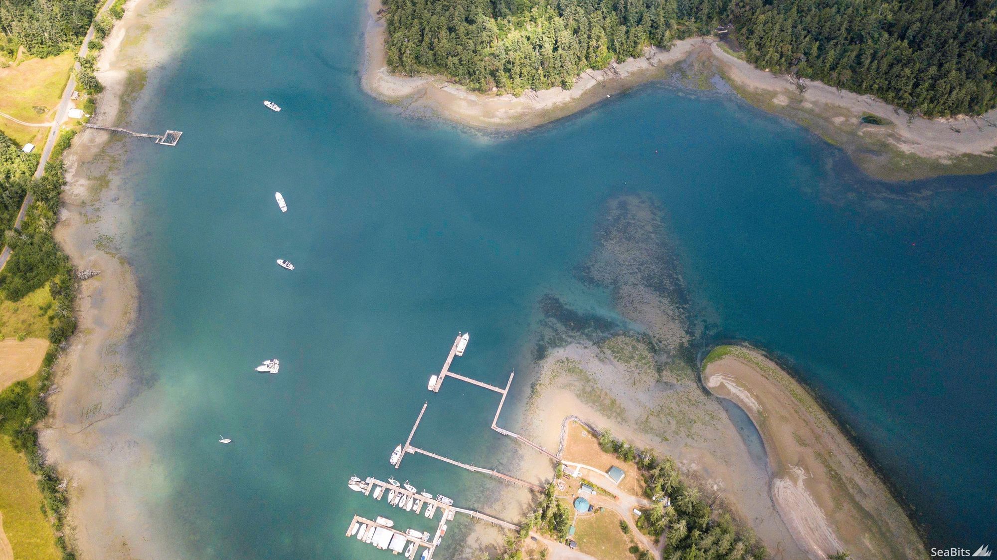
Here's a clearer view of the entire entrance and a portion of the bay. The various shorelines both underwater and otherwise are just wonderful to see from above!
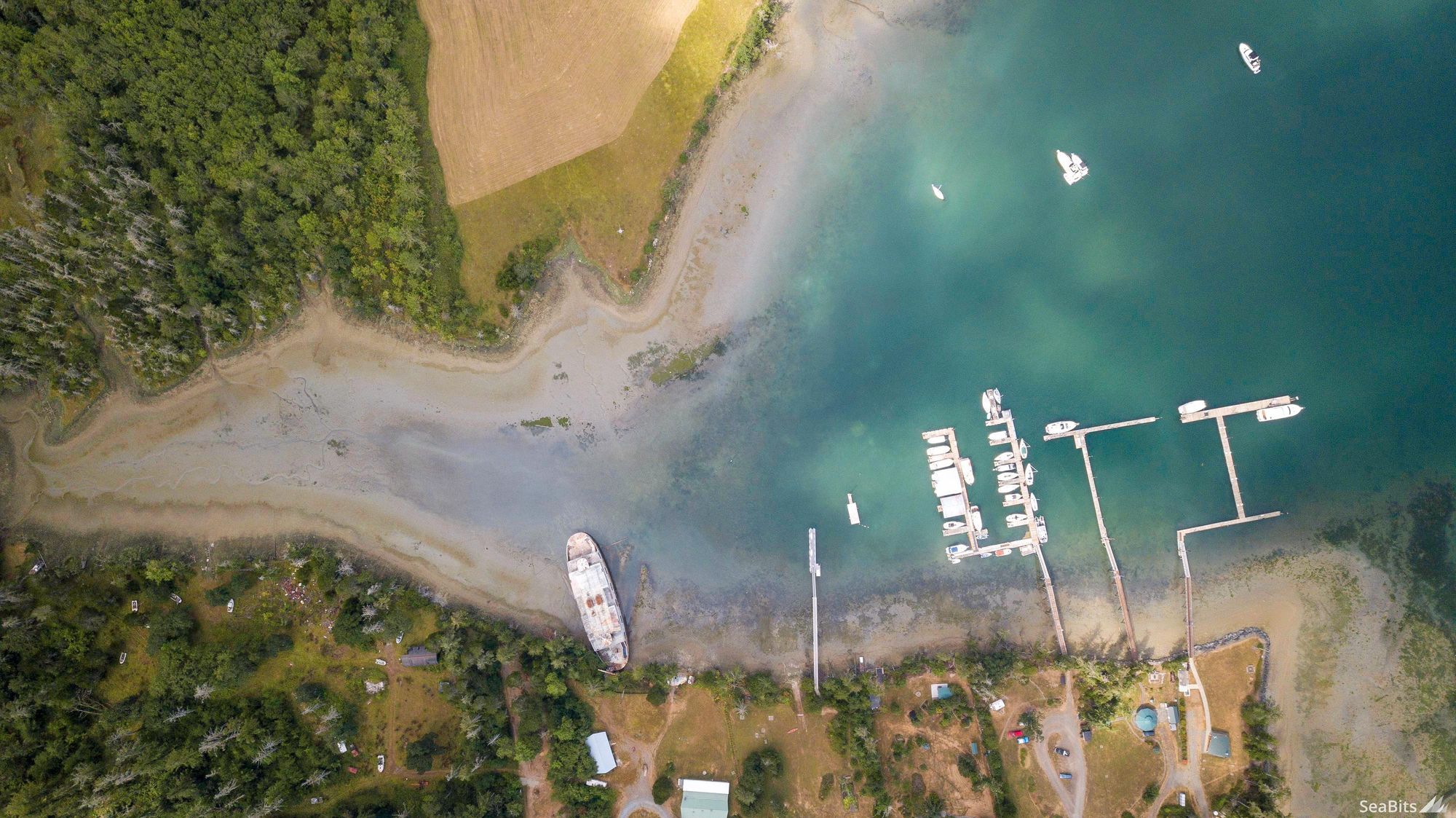
One of the things folks love seeing in Oro Bay is the abandoned ferry in the south west corner. The Seattle Times had a story on the ferry a number of years ago.
There is quite a bit of area to explore via dinghy around the bay including the ferry and a bunch of little coves and inlets.
In addition to the ferry, the bay hosts three yacht club docks - Oro Bay Yacht Club, Bremerton Yacht Club Outstation and Tacoma Yacht Club Outstation which you can see in the far right of the photo.
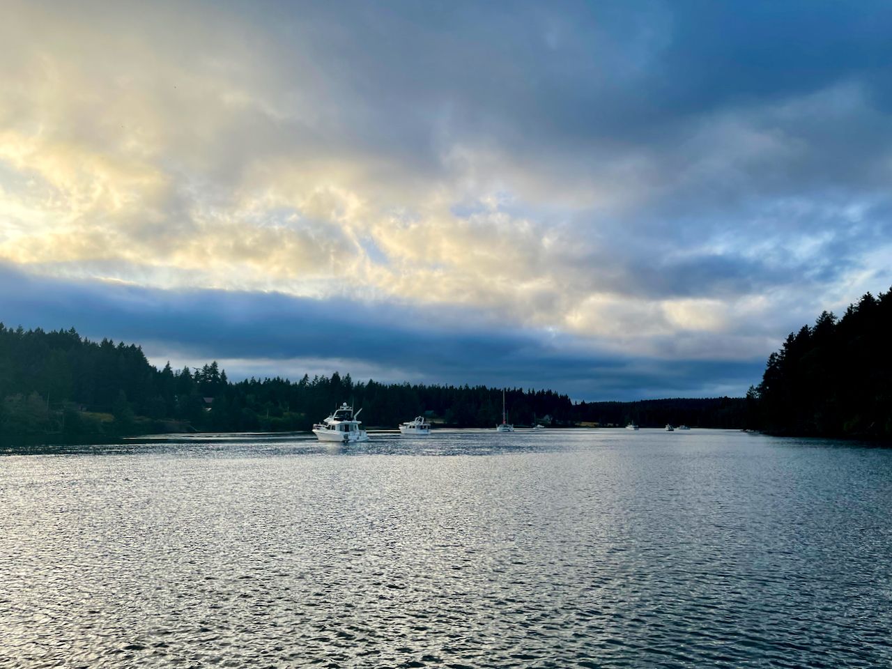
We were in Oro Bay for 4 days or so, and had wonderful weather and sunsets.
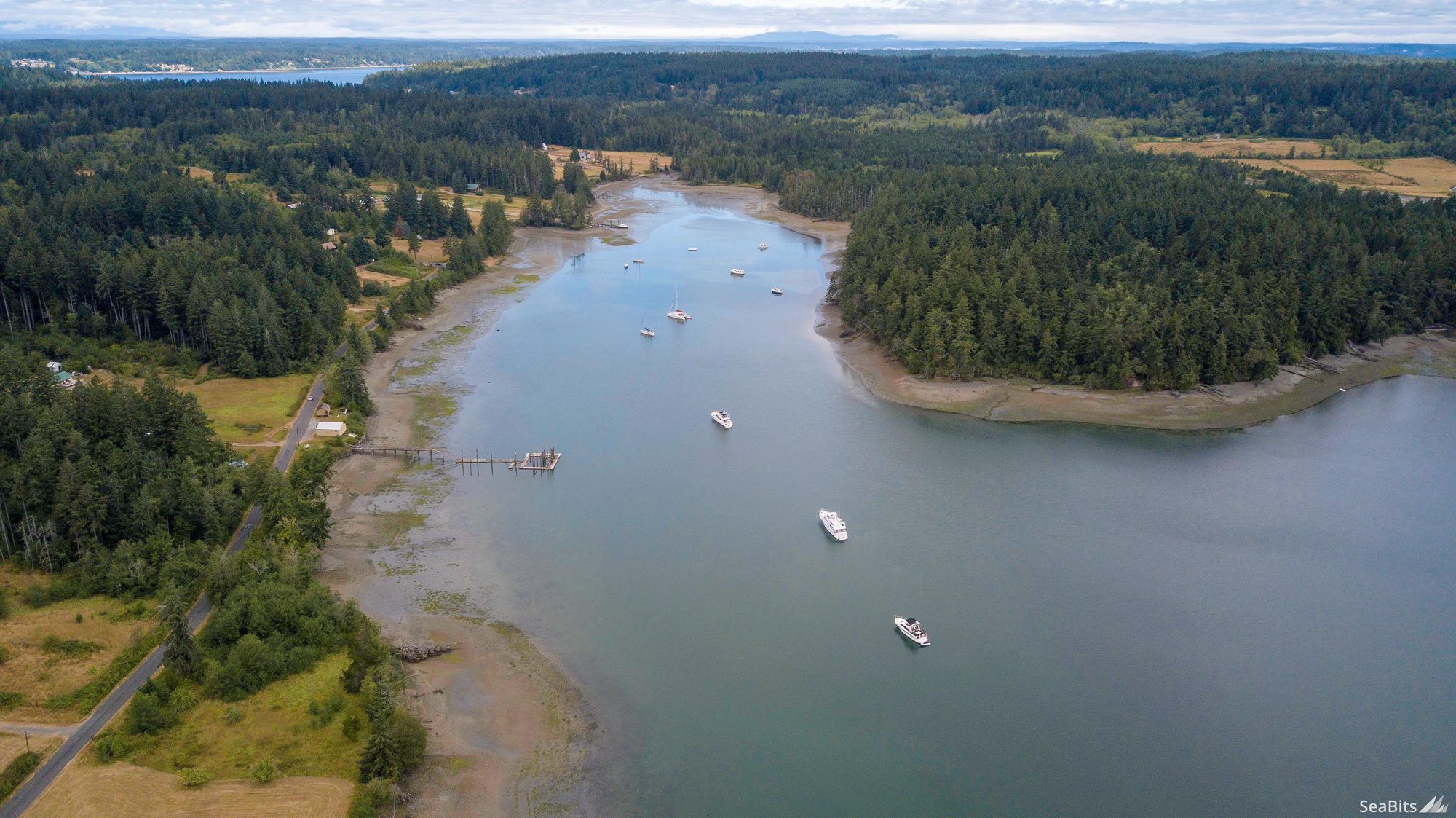
I was able to fly the drone a bit later during our trip during a very low tide. You'll notice how all of the boats anchored are in a line, which is a funny happenstance. Also, going back to the depth charts, we definitely could have gotten closer to the shoreline on the right of the picture as it goes much further in than the older charts show.
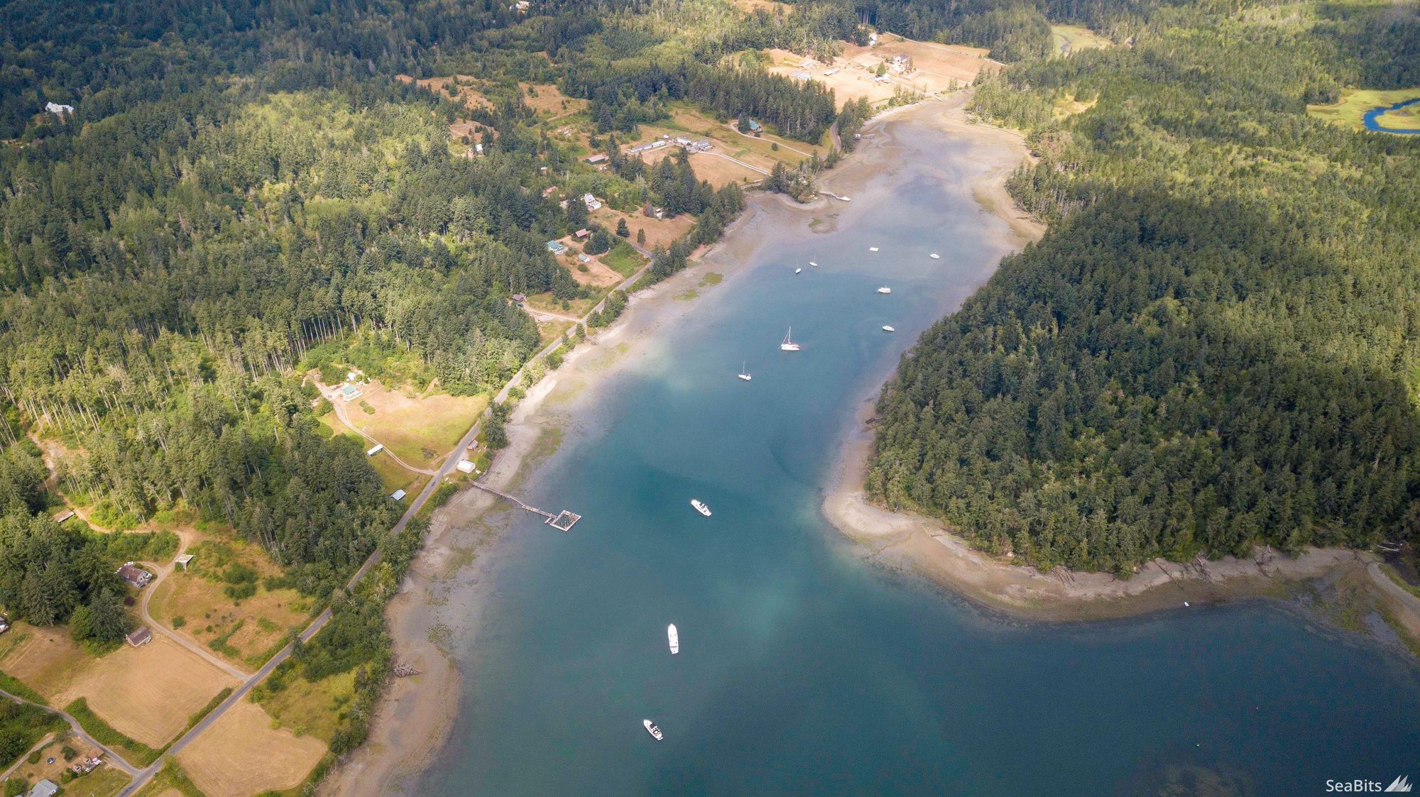
In the background of the photo above you see the Nisqually river delta and National Wildlife Refuge which has been undergoing restoration for many years. It is a fantastic place to walk around, although not reachable via boat from the water side. In addition, there are a number of shipwrecks that are visible at low tide along the delta and make a great day trip via dinghy.
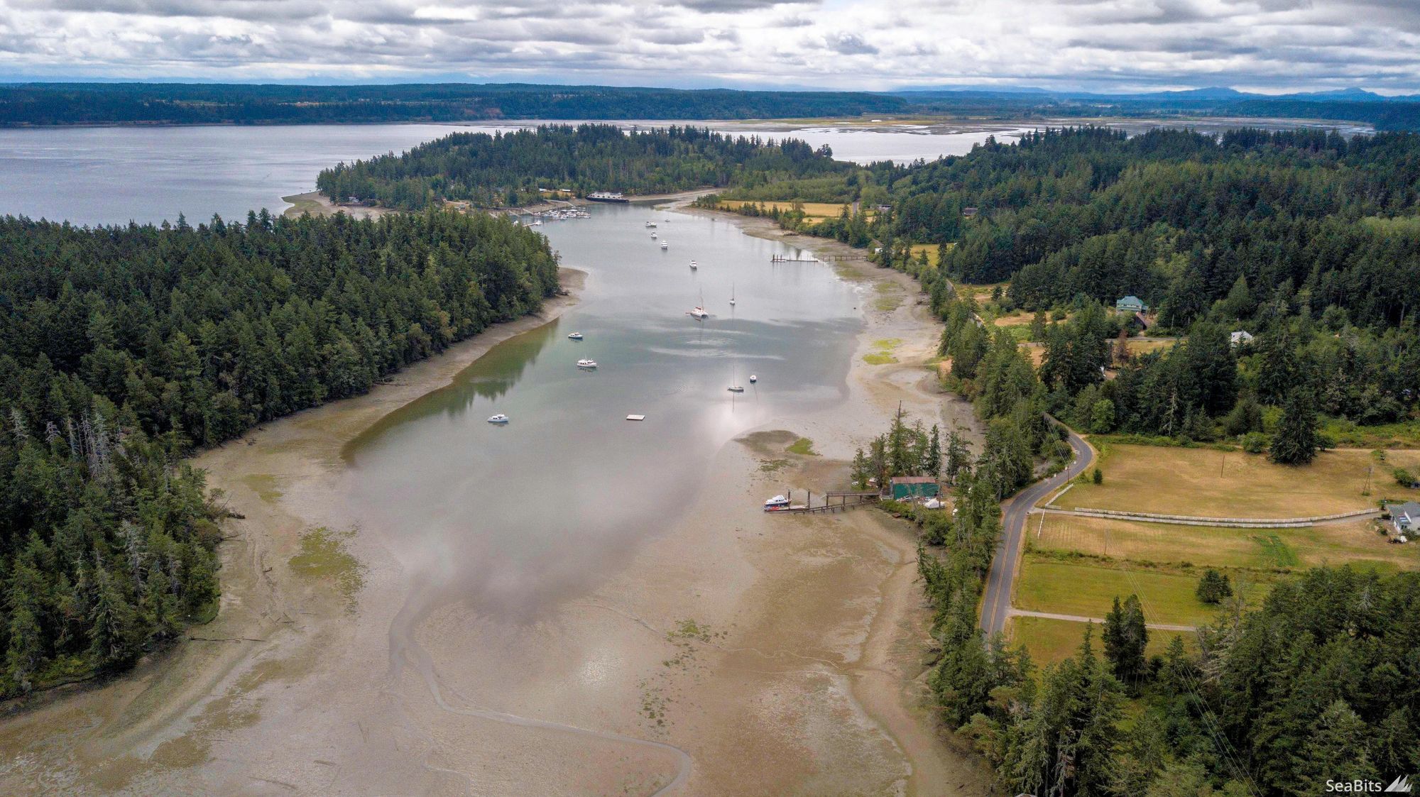
The bay is quite large, but the north end gets very shallow. There is a fairly sizable trawler fully in the mud about the middle right of the photo tied up to the dock!
There is plenty of space both in the main southern portion of the bay, but also up the narrower middle part for anchoring. Again, there is more space there compared to what the charts say, but I wouldn't anchor any further back than where the catamaran is in this photo unless you have a shallow draft.
You can see in this photo that some of the boats further into the bay are pretty close to the bottom - or at least you can see the bottom showing up lightly in the photo.
I love Oro Bay because of how quiet it is, the smells of the nearby grasses and farms, and all of the wildlife that seems to come and go through the year. I have seen more birds here than just about anywhere I can think of, and seals seem to be prevalent and curious here too.
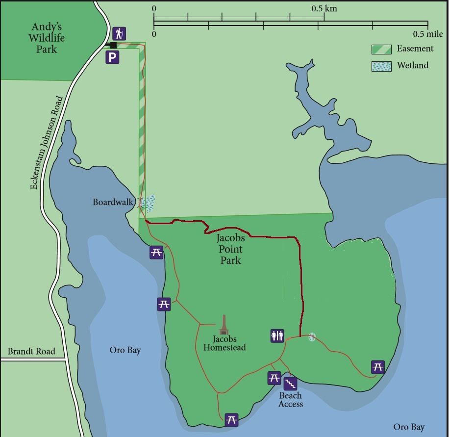
The Jacobs Point Park surrounds one part of the bay and is a great place to explore. I've beached my dinghy near the "Beach Access" spot and been able to go ashore and walk around. There are several other spots to the left of that beach (you can see a dinghy in some of the drone shots) that can be used as well. Around the right side of the park and back into the inlet is also a wonderful spot to kayak or paddle board and watch the wildlife.
Andy's Marine Park
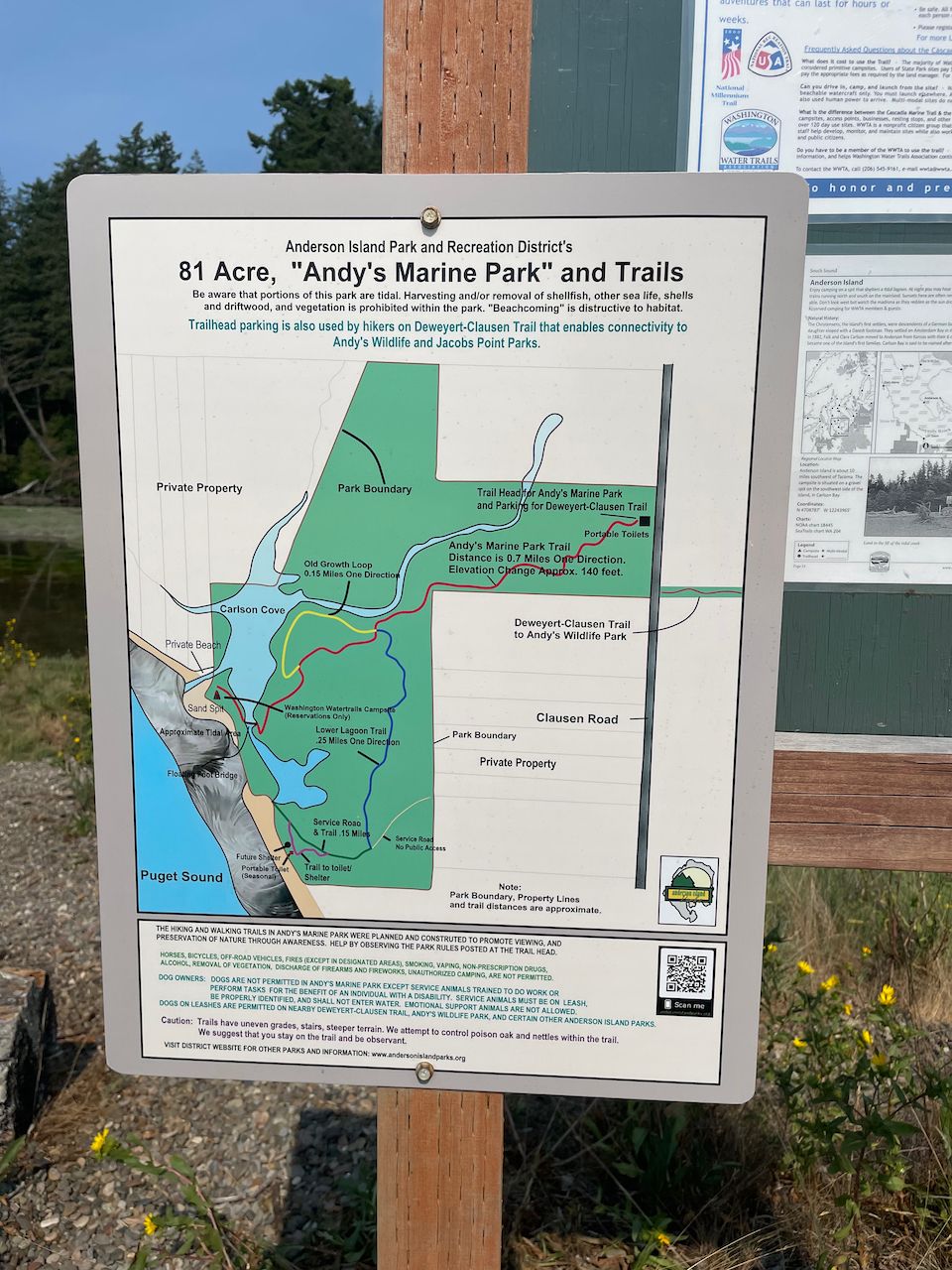
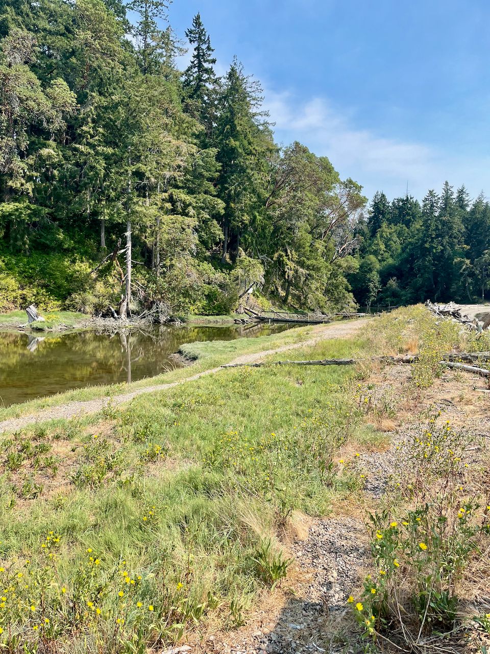
We decided to circumnavigate Anderson Island via dinghy one of the days we were there, and found a wonderful marine park named Andy's Marine Park on the west side of the island. It's an 81 acre park with a cove, inlets, foot bridges, and wonderful beaches. I would like to go back and spend more time exploring!
There were lots of other things to see on the circumnavigation including a few cool bays, birds, and of course Eagle Island Marine Park on the north east side of the island, which I visited back in 2016 on Grace and is another one of my favorite spots down here.
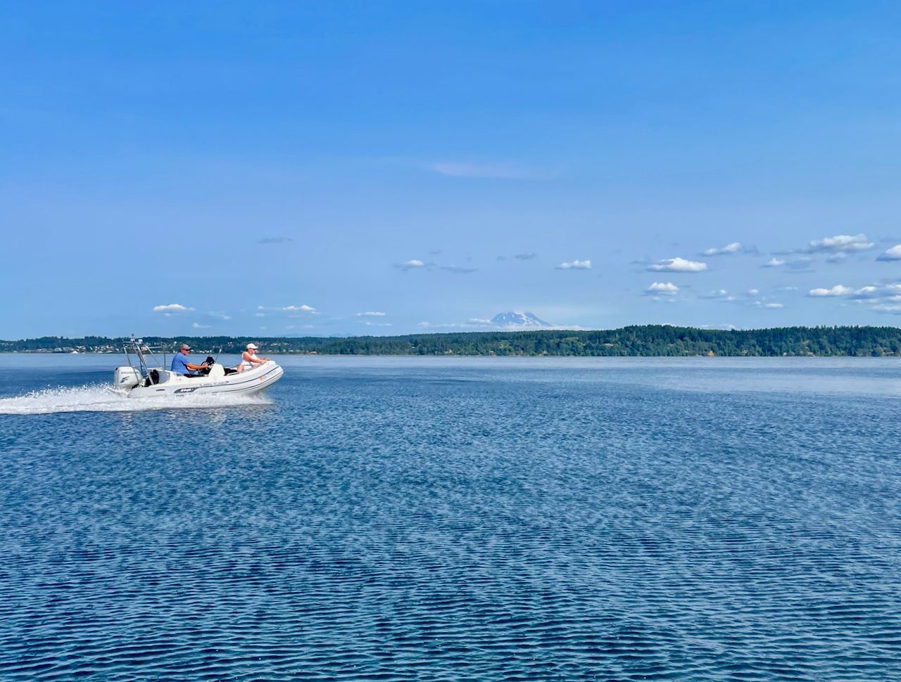
Mt. Rainier is prevalent in the south sound, and seems much closer than it does even from Seattle. From outer Oro Bay, or even the entrance, you can usually get some pretty good pictures of the mountain.
I've pulled up some weird stuff in Oro Bay over the years on my anchor. One time it was a huge hunk of piling, and another some weird thick line.
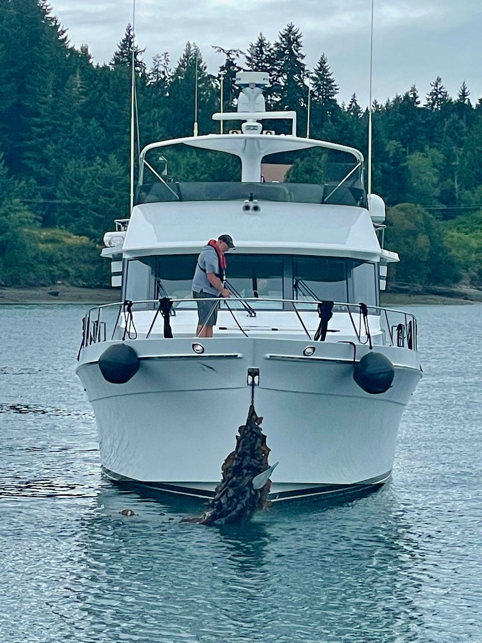
This time around it wasn't my turn - Conundrum pulled up a huge amount of kelp that took some time to release.
Oro Bay is one of my top destinations in the South Salish Sea, and I always try to visit at least a couple of times a year. As long as you enter on a non-zero tide, and follow the buoys, you'll have no problem enjoying this wonderful little anchorage!
Archived Community Comments
These comments were posted on the SeaBits forum before February 2026. Scroll down to join the current discussion.
Without those shoals and bars, Oro Bay wouldn’t be so calm and snug!
Thanks for the drone photos with the bottom contours. Convincing display of a perfect snug harbor. I always appreciate your well researched and presented trips and gear talks. One of the very best on the entire web.
Thanks for the kind words! The photos are very revealing!
I did not know about Oro Bay. Thanks for the tip!
Great story. Lots of helpful information here. Thank you.
You inspired me to visit this coming weekend, but I’m hoping
to pickup a college football game one night. What’s the cell service like there?
I know your cell reception will be better than mine but we have a PepLink and
External Signal booster currently. New and better setup coming in the future as we follow your recommendations.
Thanks again…great site.
Hi @SteveM,
That particular location can be hard to get a good signal without an outdoor antenna. Your booster should help, but try it without the booster too - you might be OK without it.

I had the best results with Verizon and AT&T. T-Mobile was not very usable at all.
Thank again Steve. Appreciate your help.