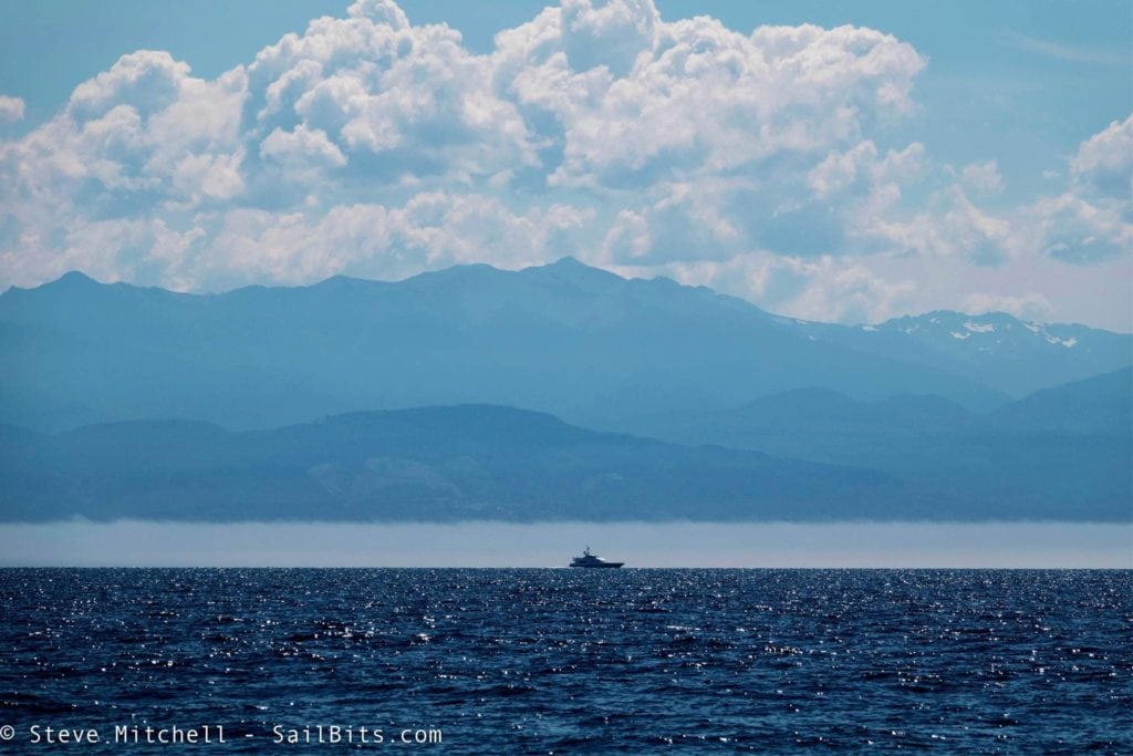
After visiting Princess Louisa Inlet, one of the most picturesque places on the face of the earth, it was time to return home to Seattle. The journey from Pender Harbour back turned out to be much more difficult than getting there, but it also was just as memorable as the rest of the trip, and spawned ideas of future visits all through Canada.
This part 3 of my trip to and from Princess Louisa Inlet. Part 1 and 2 are available here.
The Route
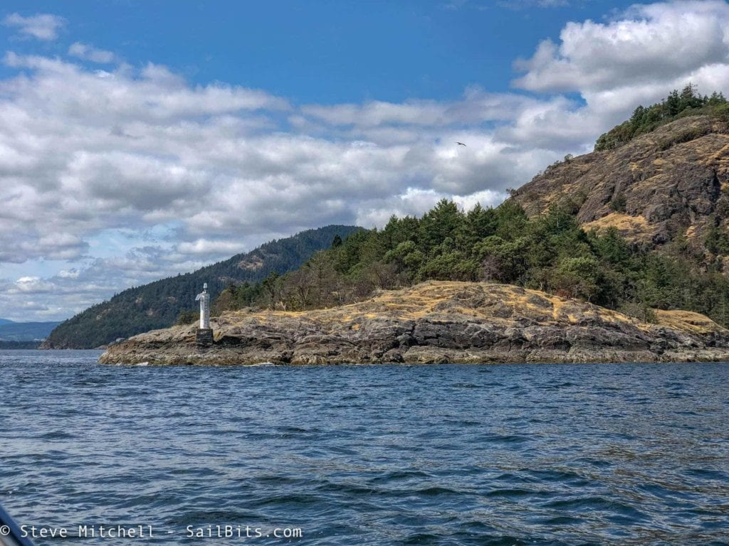
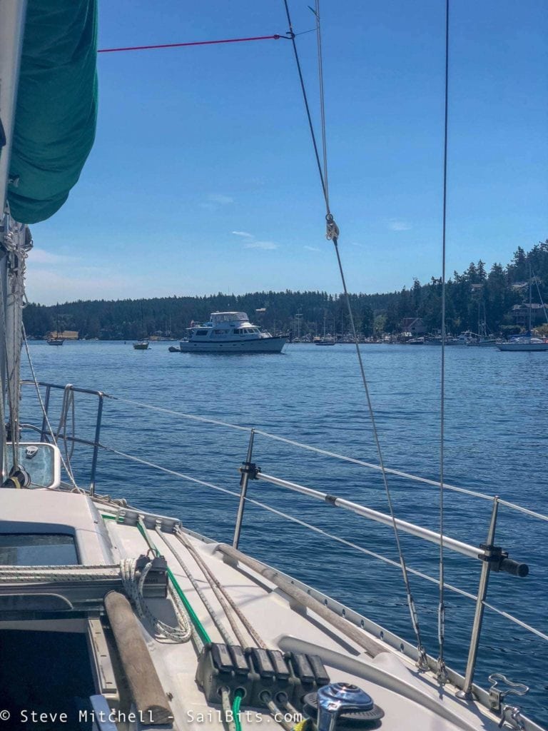
Our route back was still in flux mainly because of the weather to cross the Strait of Georgia. However, we wanted to try to go back a slightly different route – Pender Harbour to Nanaimo, then to a couple anchorages somewhere in the Gulf Islands, and finally to Friday Harbor.
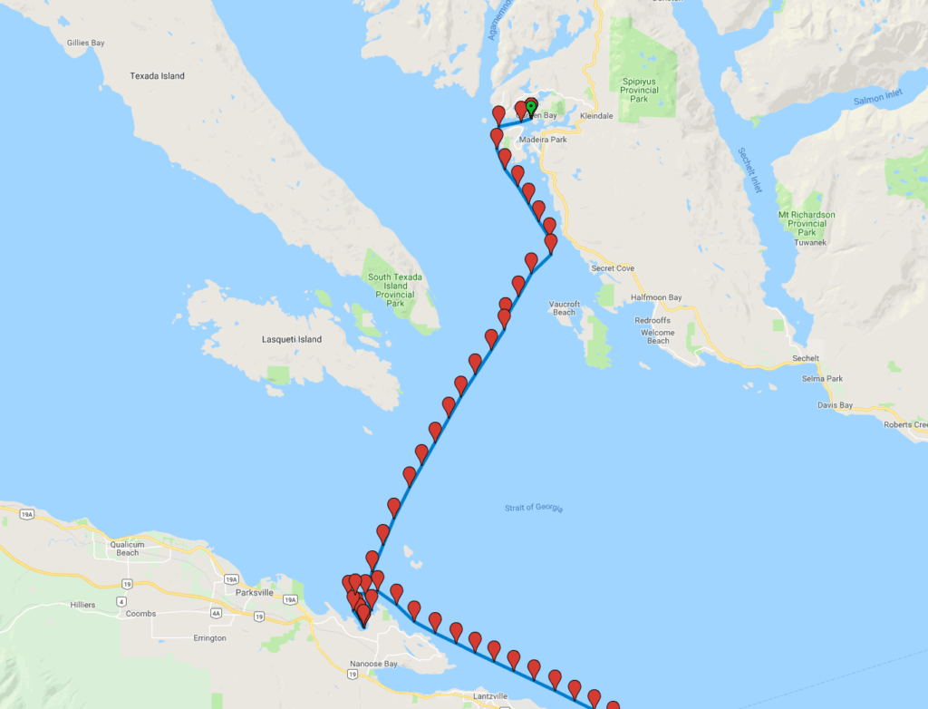
Here’s the route that my data recorder captured up until the final anchorage night in Genoa Bay. I was playing with some beta test instruments at that point and the recorder stopped gathering data, but the rest of the trip was pretty standard. You can see the map on Google Maps here.
The Worst Day So Far
After resting half a day in Pender Harbour, our plan was to head either to Secret Cove, or try to cross the Strait of Georgia. The forecast for the next few days was not looking happy for the crossing, so it felt like we should probably cross the Strait today, based on the fact that the wind was supposed to be only 15 knots and pretty calm in the afternoon.
As soon as we left the protection of Pender Harbour, the wind and waves kicked up. Not just a little, quite a bit – 20 knots gusting to 25 with 2-3′ waves directly on the nose. I was pounding through the waves again, heading down towards Secret Cove.
After some discussions on the radio between me and Sea Bear, we decided it was better to try to cross the Strait of Georgia now rather than heading further down the coast and getting stuck waiting out the worse weather we know was coming.
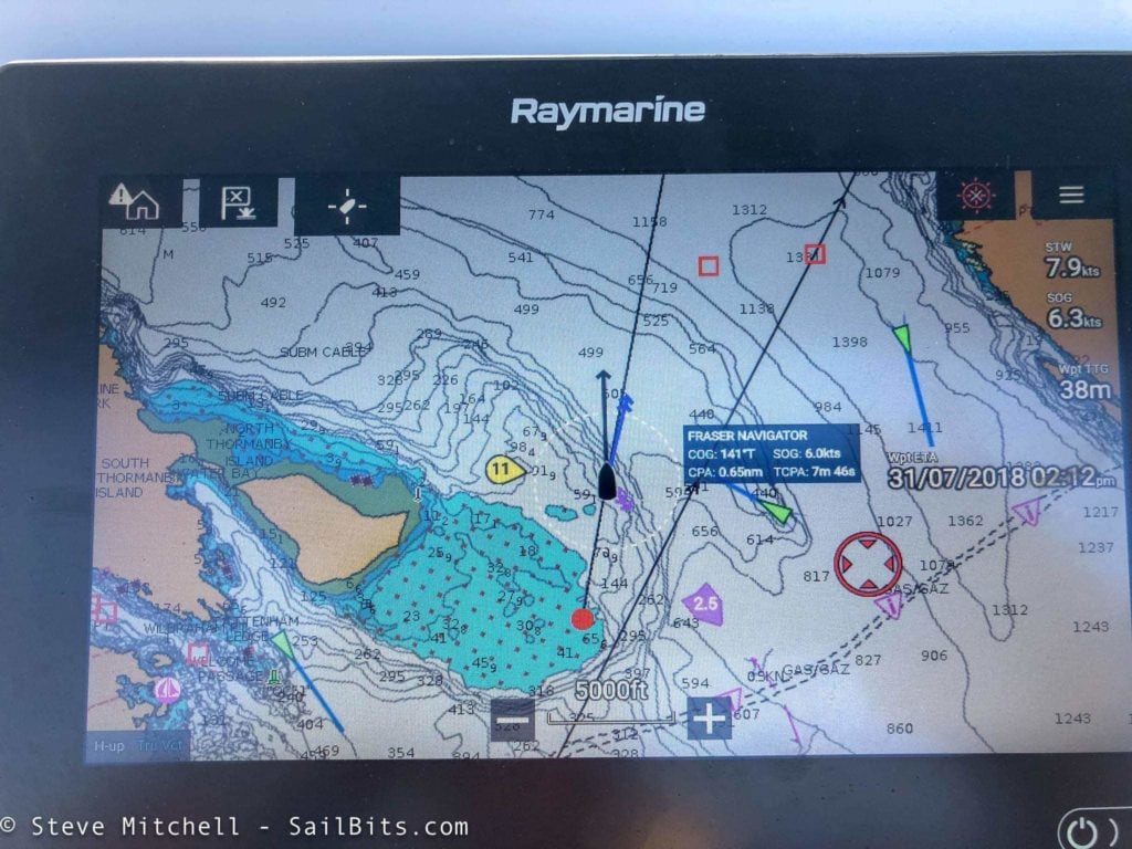
So we made the turn to point out across the Straits. I had to avoid a tug coming down out of Agamemnon Channel and AIS and my Raymarine radar helped yet again to ensure we were definitely not going to have any issues.
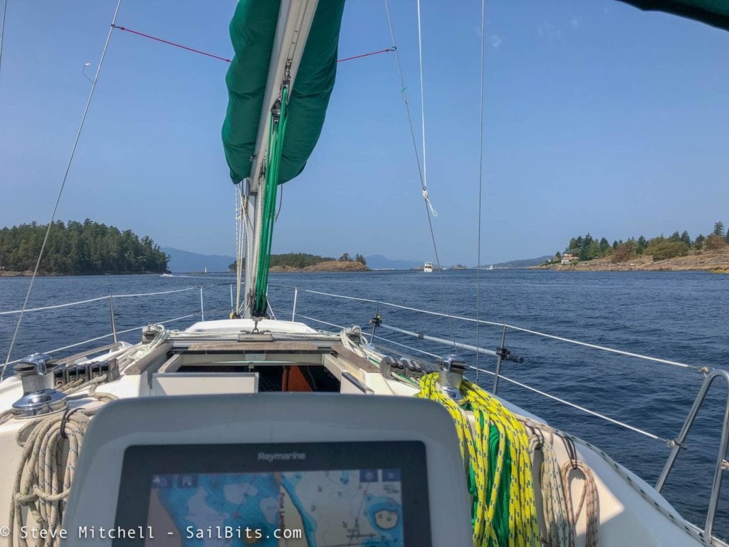
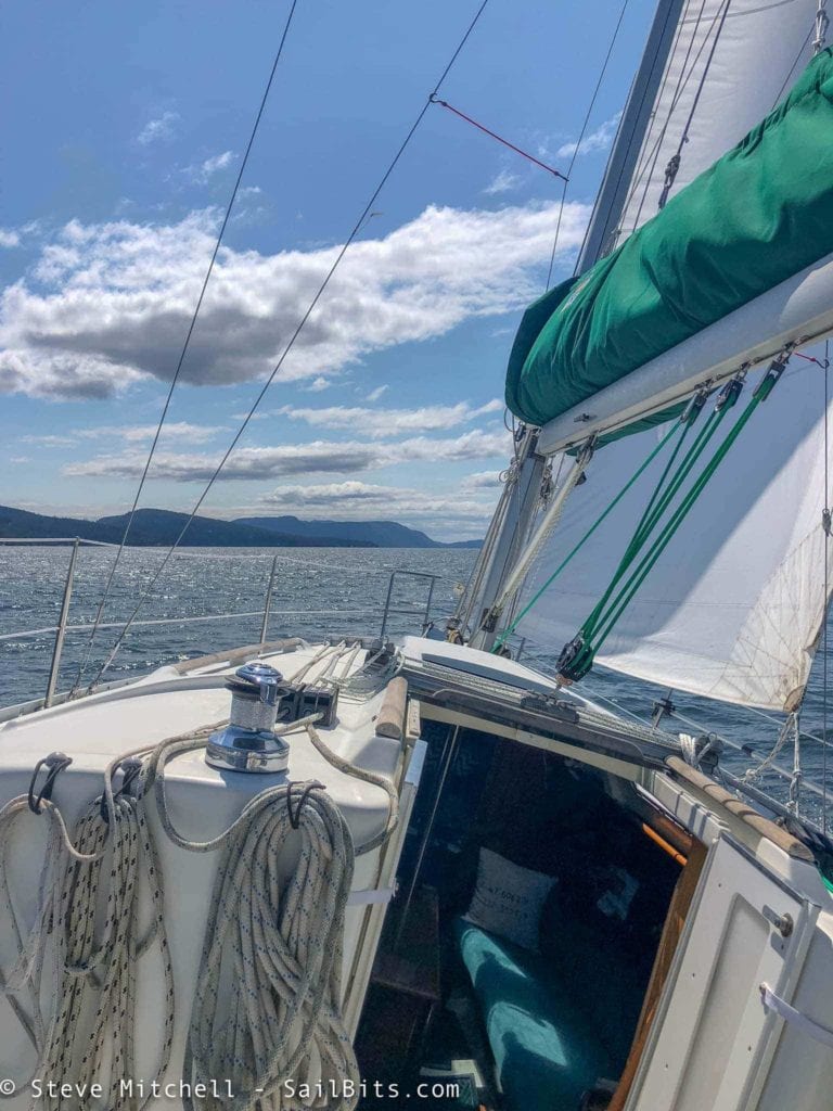
Here you can see the turn we made just a bit north of Secret Cove, and then the relatively straight path I took across the Strait of Georgia. While still in the lee of Thornamby Island, I put the main sail up, reefed to the second reef point, and threw a portion of the jib out. I knew it was going to be a beam reach across the Strait, and I wanted some sail to help stabilize things. Little did I realize how important that would be.
About 30 minutes in, I knew I was in for a very eventful day. There are no pictures, videos, or other digital media, as I put everything down below, secured the entire boat, clipped my harness onto my PFD (first time this trip) and had my Garmin inReach attached to my belt.
For the next 2+ hours, the boat was never really below 8 knots of speed through the water, and the wind never went below 20 knots. Several times I saw 9 knots of boat speed and 30 knots of wind. The waves were the largest I have ever been in with Grace, and I’d say some of the top 5 waves I have been in period. I was on a beam reach with the waves marching along off the port side.
Grace was amazingly stable and rode the waves up and down as they came up her side, giving me a view of even more scary waves with whipped tops coming for me, and then down into the trough with nothing but water around me. I had my Reliefband on at the highest setting, knowing I was going to get seasick.
About an hour into the crossing, Sea Bear, who had been ahead of me, turned directly south and started pounding into waves. About 10 minutes later, they hailed me on the VHF and said they had a major disaster on their hands, but everyone was OK. The boat had been seriously rolled by the big waves, and cabinets that had likely seen many heavy weather passages opened and dumped their contents everywhere.
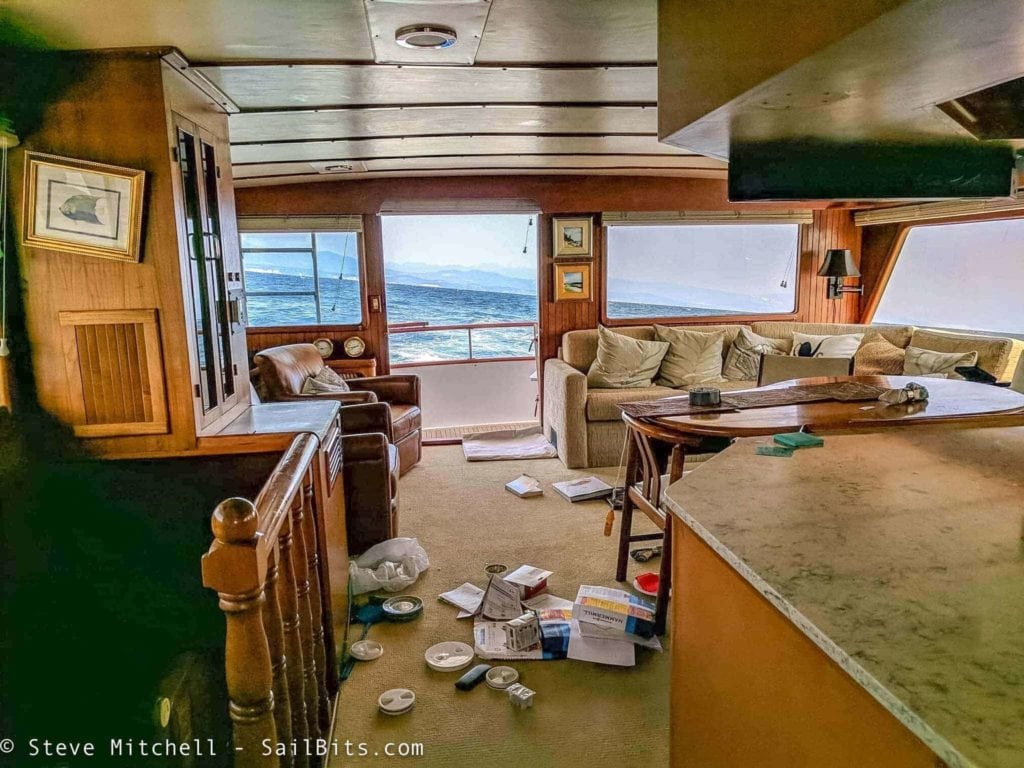
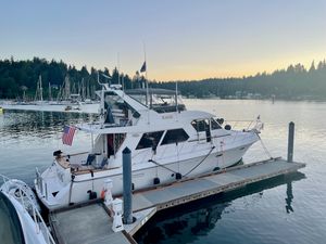
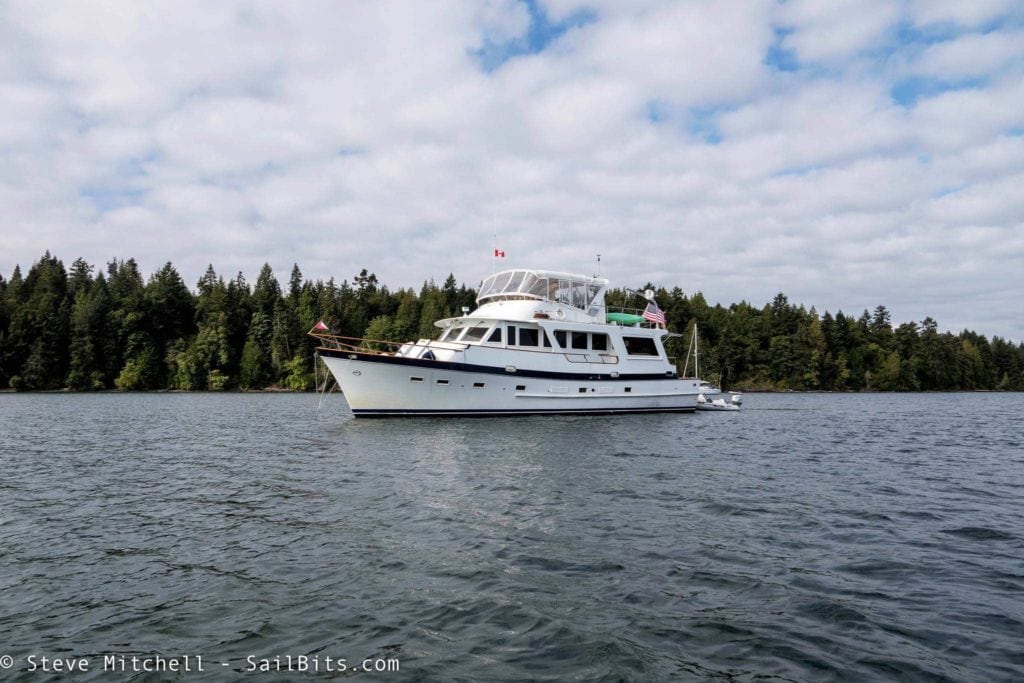
This is the only picture that was taken of the damage, which was far more extensive. What is really telling is the line of the horizon – and this was when the waves had calmed down a bit. Sea Bear is a 62′, 100,000 pound Angel motor yacht, and usually very stable.
Besides the damage you see above, dishes and many bottles also smashed out into companionways. The new full size fridge and gas oven hopped out of their cubbies. The worst was a bottle of olive oil on the brand new carpet in the walkway. But the most concerning was Isabelle – Steve Robert’s companion and kitty who for some reason decided the safest place in the rolly waves was on the flybridge back deck, where there are virtually no lips or railings to keep her onboard. Steve found her after frantically running around the boat searching after they were pitched to the side, and rescued her. She remained in a lower cabin (locked in) the rest of the crossing.
This should give you some indication as to how big and choppy the waves were – it was pretty epic. They ended up cleaning up what they could while heading directly into the waves, which was also not too pleasant, and not the direction they wanted to go.
After cleaning, they began a long process of tacking back and forth through the waves like a sailboat – a bit of progress pointed directly into the waves, and then some with the waves on the quarter.
At one point, captain Holly called me on the VHF and gave me an update, and asked if I were the sailboat 3-4 miles in front of them – I was! For the first time the entire trip, I was soundly beating Sea Bear, and I was OK with that. At least everyone was safe on both boats, but none of us were comfortable.
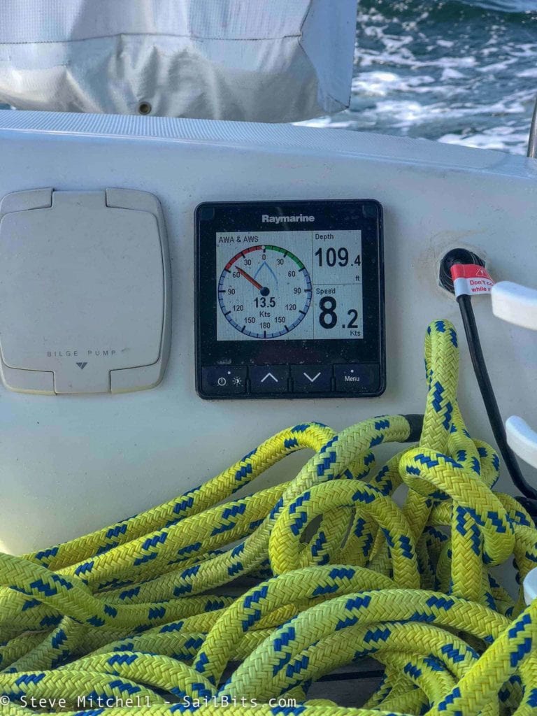
Meanwhile, I was still riding the waves, which got even larger after we passed the end of Lasqueti Island and neared the Ballenas Islands. The waves were now top 3 I’ve ever been in, and while I was worried given the conditions, the boat performed flawlessly and had no issues. She was as stable as could be, which really, really pleased me. Double reefed mainsail and a tiny part of the jib, engine at about 1/4 RPMs using the Gori overdrive propeller mode, and we were scooting along at 9 knots most of the time, and very stable. I still never left the cockpit as I knew I would get instantly sick going below.
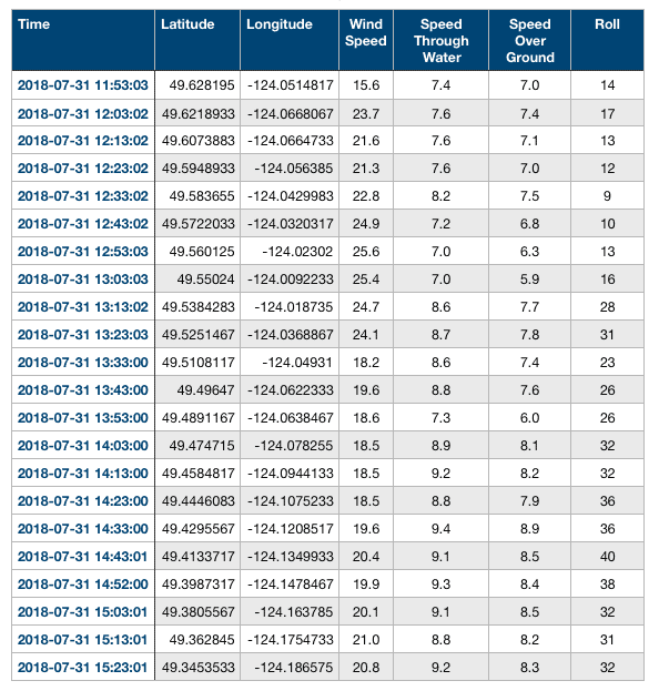
Here you can see the data my recorder was gathering, summarized every 10 minutes for the entire crossing. I was in 20+ knot winds dealing with the big waves from around noon until 15:30 – so about 3.5 hours total. It felt like a lot more than that.
The data shows average winds starting out at 23-25 knots, and then “calming” down to 18-20 knots as I got further across. My speed through the water went from pounding through things at 7 knots, to a nice 9 knots the last 1.5 hours or so. You can see where I turned and was in the trough of the waves around 13:13 when the roll goes to nearly 30 degrees and stays that way until I’m across.
I made the choice, being the lead boat, and given that our original plans had us going to Nanaimo (too far away now given the course I was holding) to head for Nuttal Bay with Northwest Bay being a backup location. I got into Nuttal, headed upwind, dropped the main and put away the jib, and almost instantly got massively seasick. I motored around Nuttal Bay looking for some protection, but I didn’t find hardly anywhere that would work save deep in the bay near a bunch of other obstructions.
So I motored out and around to Northwest Bay which was much larger. The wind was still pretty uncomfortable even near this part of the coast, but once I got deeper into the bay it calmed down considerably. By this point I was feeling pretty horrendous due to my seasickness. Sea Bear caught up with me at that point, ready to not be on the water as well I am sure!
I couldn’t bring myself to deal with anchoring, so I did some circles while they found a good spot, and I rafted up against them. Within about 15 minutes, I was asleep – my body basically shuts down when the seasickness gets to a certain point. After an hour or so nap, I went next door to see the carnage and swap war stories.
Northwest Bay is very calm and quiet and decently protected from everything but (you guessed it) a north west wind. Sea Bear was definitely the loser during today’s crossing – it was absolutely miserable for them with the way the waves were stacked up along with the wind. We knew it might be a difficult crossing, but we were glad everyone was safe and sound on the other side.
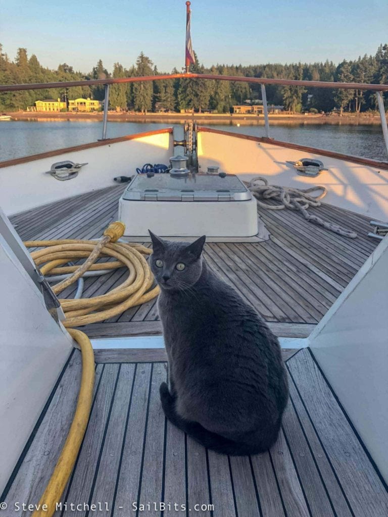
In particular, we were all glad Izzy did not decide to jump overboard from the flybridge! For the rest of the trip, whenever there were even threat of some rolling, we made sure she was safe belowdecks.
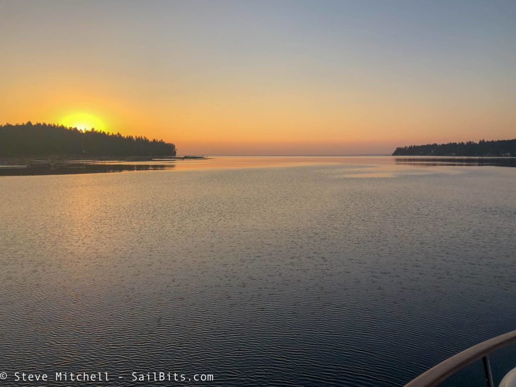
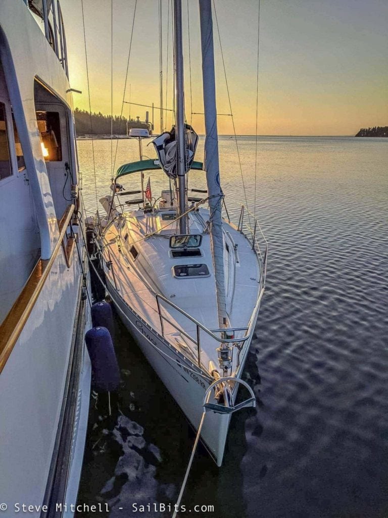
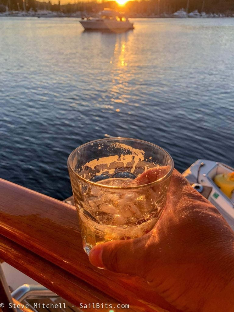
Captain Holly is now considering adding more secure latches to particular cabinets to ensure the olive oil issue doesn’t happen again. There are ongoing discussions about how to secure the fridge and oven, which are a bit more of a challenge. Nevertheless, after another wonderful dinner aboard Sea Bear, we all enjoyed the sunset, and went to bed early.
More Pounding Down the Coast
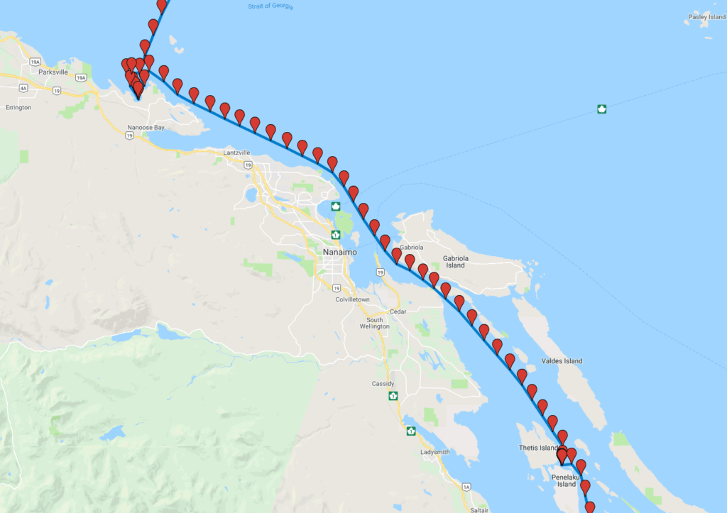
The next day I was prepared for more wind and waves as we made our way down the coast past Nanaimo, through Dodd Narrows, and to Clam Bay, which is between Thetis and Penelakut Islands. We had stayed there on our trip up to Princess Louisa.
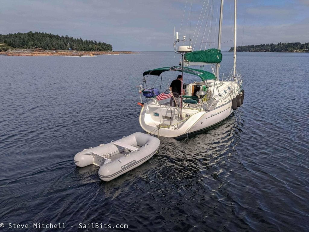
Steve Roberts of microship.com took this wonderful photo of me motoring away from Sea Bear. The bay was calm, but the usual 3′ waves with an occasional larger one came up as soon as I rounded the point.
The video above gives you an idea of the wave size, although the camera always makes it look smaller. The wind was definitely around 20 knots, with higher gusts as we got closer to Nanaimo. It was a good solid 4-5 hours of plowing through this.
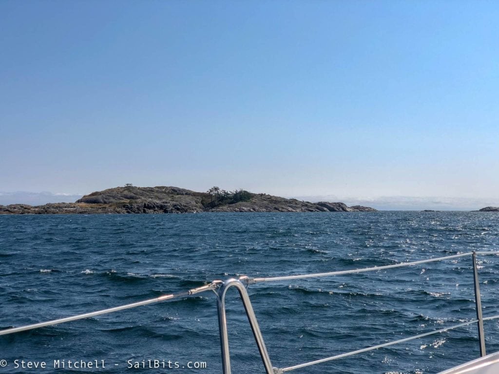
There were a lot of little islands to gaze at while pounding through the waves, and I had hoped they would give me some protection, but that was not happening.
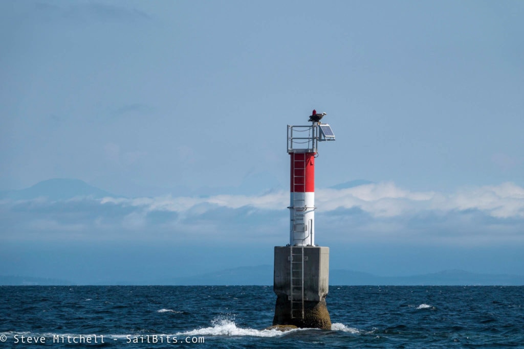
Even the eagles found it too hard to fly, and just watched me motor on by.
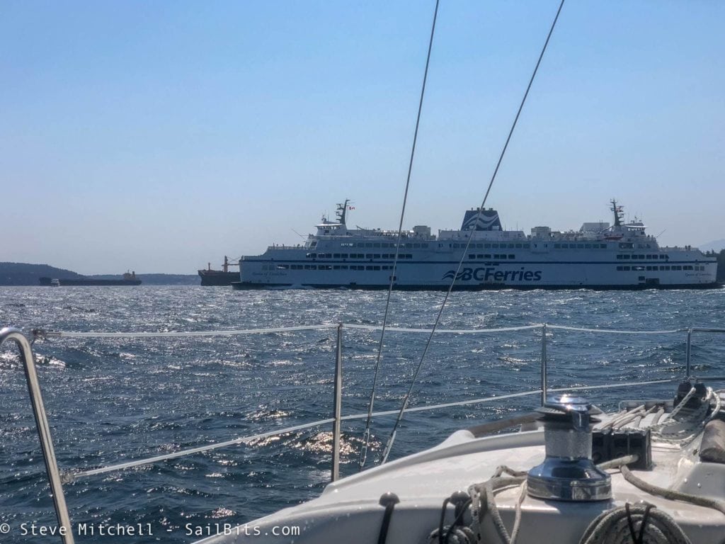
I was able to put up the jib a couple of times when the wind angle was right, and that helped me along a little. Once I got near Newcastle Island just a few miles away from Dodd Narrows, I had to avoid a couple of BC Ferries and the wind kicked up even more – gusting to 30 knots at points, but at least the waves had flattened out a bit.
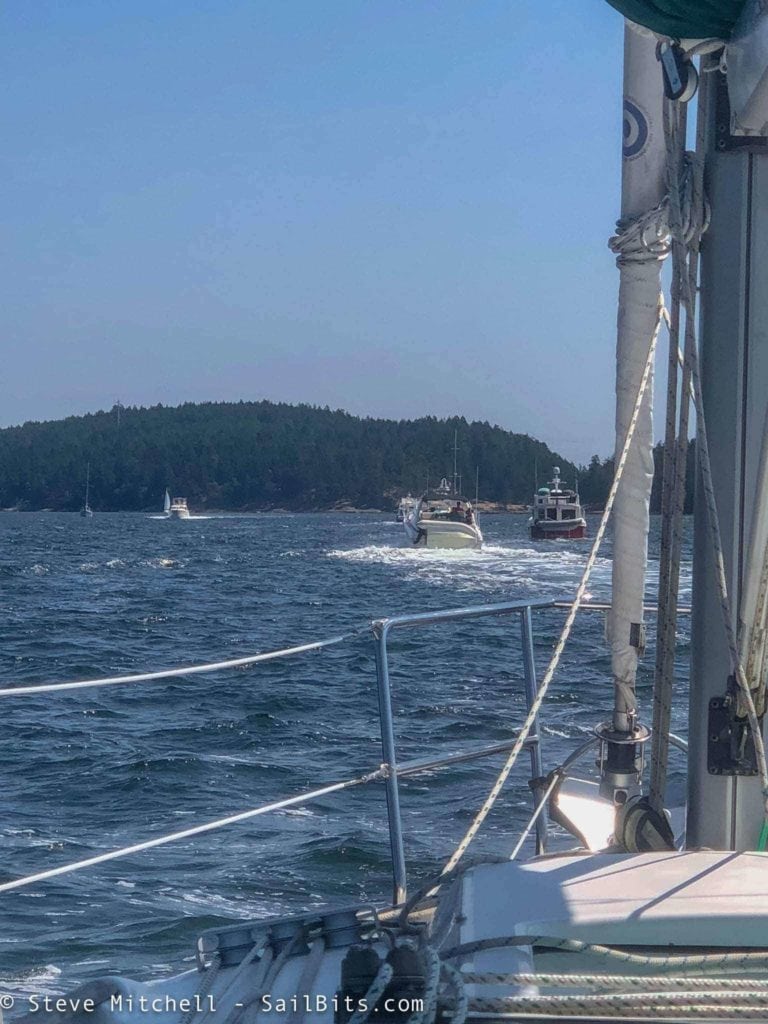
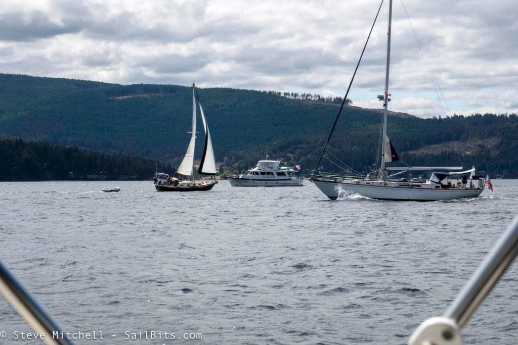
As I got closer to Dodd Narrows, the traffic increased quite a bit. Sea Bear was about 20 minutes ahead of me, and had hit the narrows right at slack.
There were 12 boats that went through the narrows all at once, with me 11th in line. A nice captain at the head of the line made one securite call listing all of our boats which saved 11 other calls. Nice job!
I was a bit worried, as about midway through the narrows I dropped to almost 3 knots speed over ground. I was slightly late from slack, but I didn’t expect it to be that bad. The power boat behind me passed me, and I was literally the last boat I saw come through during that cycle. Everyone else was going the other way.
The rest of the motor up the channel towards Clam Bay was absolutely wonderful. Small waves, a nice breeze to keep cool by, and the stereo cranked up! Sea Bear was about 45 minutes ahead of me at the anchorage.
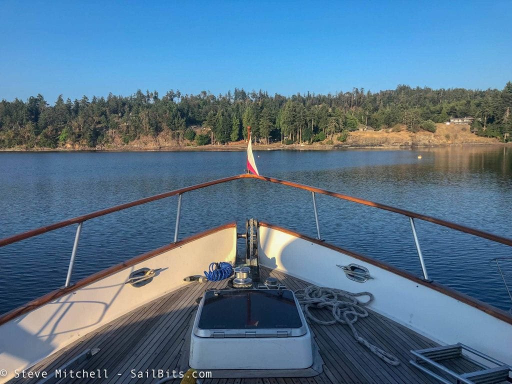
This was also the first time I decided to anchor Grace on this trip. Most of the ground tackle was new – new Rocna anchor, full chain rode, and the new Maxwell windlass with wireless remote. It all worked flawlessly, and the anchor set on the first try, as has been usual every time I have used a Rocna. I had a smaller one on Grace and used it a few times, but on Jammy I anchored hundreds of times with my older Rocna.
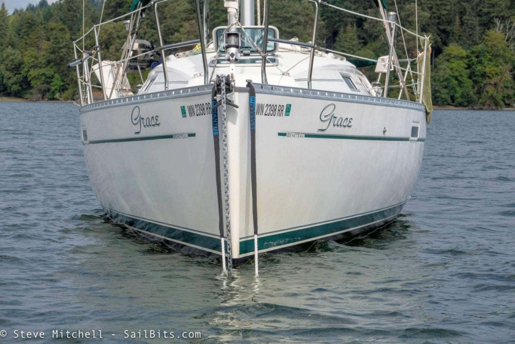
I also had a brand new Mantus swivel, as well as a Mantus bridle that I had not ever used before. The bridle was quite a bit of work to get on as it’s 35′ long, which is much too long for the boat. However, it was the one recommended – I would shorten it by 15′ or so and move the chafe protection to a slightly different position. I’ve since used it pulled in further and it works really well. The chain hook is an architectural art piece, and is much more secure than the old hook I used to have.
But if you really want to see some boat porn, check out the Mantus swivel and the video they produced. It is a work of art, and looks like it avoids a lot of the pitfalls of previous swivels I’ve seen. Around here, you really do need a swivel with a chain rode given the swing that happens, and spins that are put on your chain.
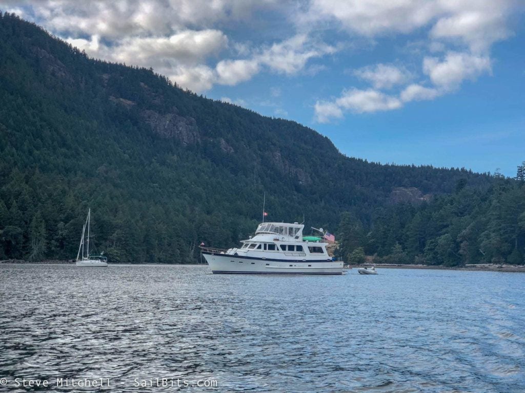
Sea Bear was anchored just a bit further south from me, and of course dinner was being served aboard!
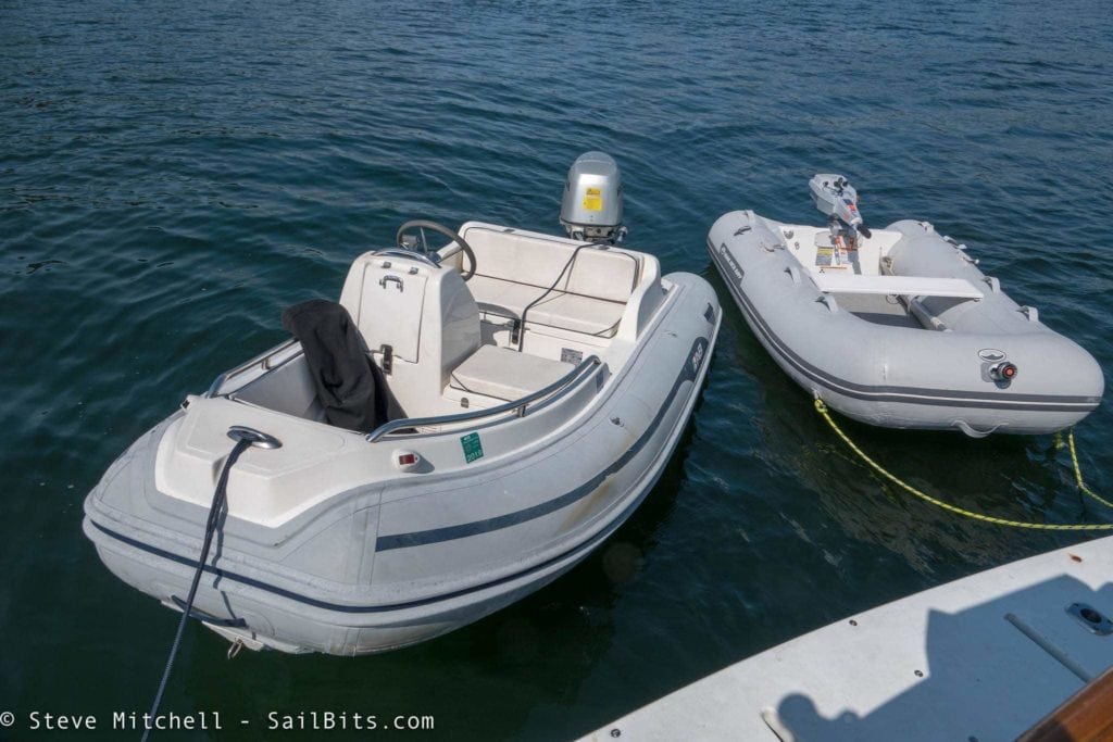
One thing I did decide on this trip was that my dinghy, while light and easy to handle out of the water, was driving me insane. I had gotten a deal on a floor-model Walker Bay air floor 8′ dinghy two seasons ago, and had paired it with a Torqeedo Travel 1003 electric motor. I love the motor, but the dinghy is like trying to pilot a floating pool mattress around whenever there is wind or waves. Without any sort of a keel it either suctions to the water and prevents you from turning, or it spins in endless circles when you’re trying to go straight in any sort of weather.
Before dinner, we dinghied between the two islands over to Telegraph Harbour. I would have liked to have more time to explore via dinghy, try out the local pub, and see some sort of museum of flags that Steve Roberts pointed out but was closed. The route to get there is through a cut between the two islands, and you need to be extra careful to follow a chart if you haven’t been through before, as it is quite shallow even in the marked channel. We went through around high tide, and there were spots where the depth was only about 3′.
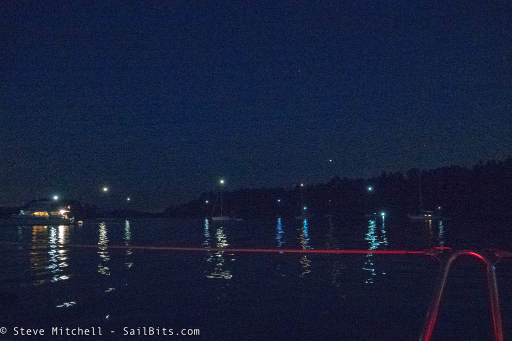
We had our own set of constellations that night in the anchorage – it was still very warm at about 85F but there was a nice breeze – one of the best nights on the water all trip!
Clam Bay to Genoa Bay
The next day we were going from Clam Bay to Genoa Bay, still a 34NM day, but mostly sheltered in the Gulf Islands. It was beautifully sunny and just windy enough to make a sailor happy. Before you knew it, I was sailing along myself, and loving every minute of it. It was one of those days where everything just works out perfectly.
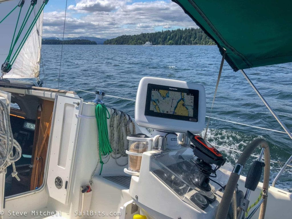
During this entire trip, I used the Raymarine autopilot heavily after planning courses the night before on my iPad, uploading them to the Raymarine Axiom, and then adjusting them throughout the day. While the autopilot had the helm, I could sit on any side, spin my NavPod that I added last year, and still keep track of everything with great sight lines. It sure made single handing the boat on this 450NM trip easier!
I even got up over 8 knots for a while, matching Sea Bear’s speed and enjoying the sun and the wind.
As we approached the Sansum Narrows, there were a number of boats that we had to avoid, including two boats that had been following us for a while. Those two sailboats would spend the next 45 minutes overtaking me and Sea Bear multiple times, then doing dramatic turns with little sea room in front of both of us at random intervals. To each their own, but these two guys were irritating. Just because you’re in front of other boats doesn’t mean you rule the world – remember when we were in front of you, and made sure we didn’t cause you an issue? Be kind to your sea neighbor.
The narrows, as expected, were uneventful, and we turned the corner headed to Genoa Bay. Captain Holly had stayed here before and liked not only the anchorage, but the restaurant and breakfast place on shore.
After one false set due to me backing down like a crazy person, we were both anchored and I went off to explore on my dinghy. There is a decent amount of room in the bay for various boats to anchor.
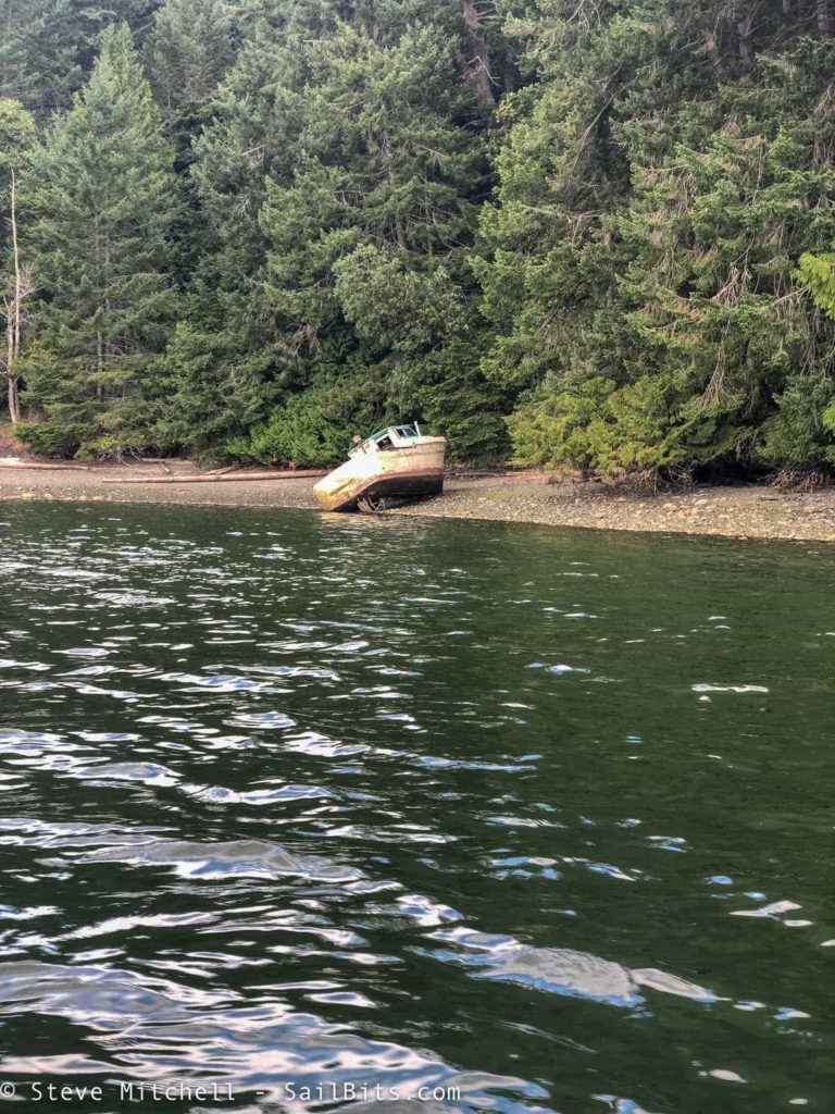
There are a few derelict boats around the bay, and a bunch of floating houses both near the marina and back deep in the bay. It was fun exploring and before too long it was time for dinner on shore. The restaurant at the marina is fantastic – I’d say the best restaurant meal we had the whole trip!
Genoa Bay to Friday Harbor
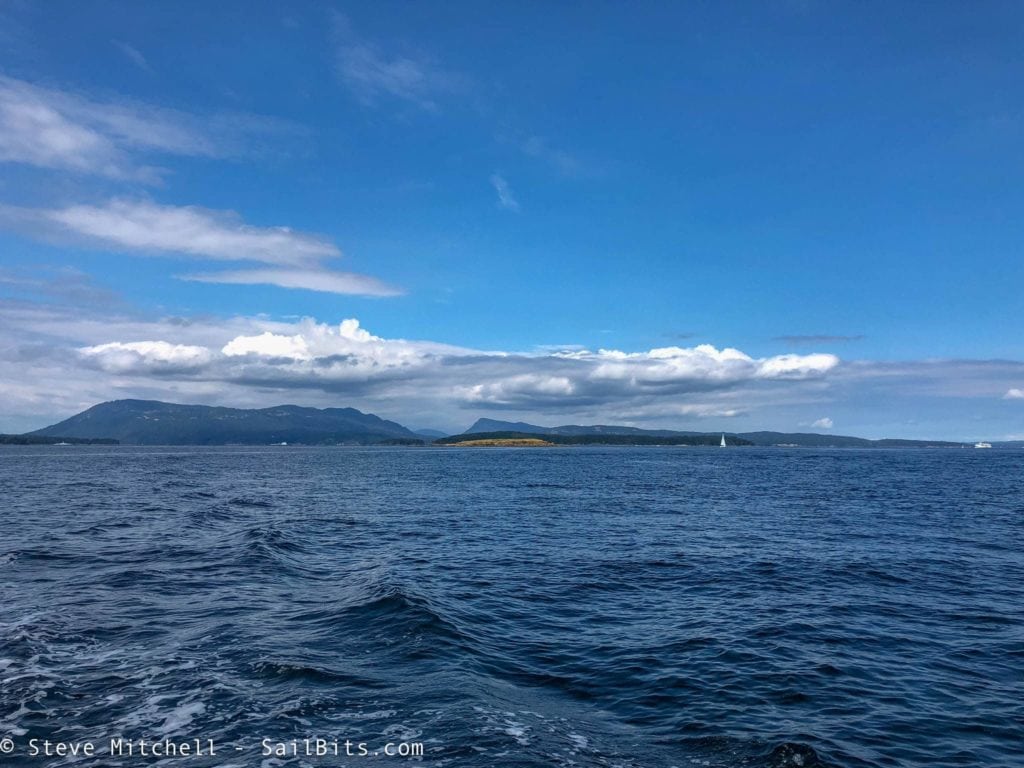
Goodbye Canada! South Pender Island and Bedwell Harbour in the distance.
In the morning, we dinghied into the dock for breakfast – the marina and restaurant have setup a small shack on the dock that serves a very short menu, but everything is freshly made and cooked to order. I tried the waffle with sausage and eggs, and it was absolutely wonderful! A great way to start out the day.
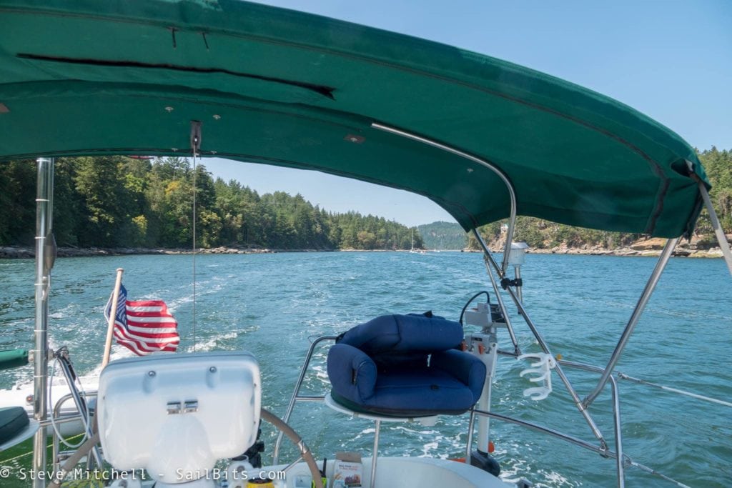
From Genoa Bay, we motored down Satellite Channel, through Colburne Passage and the busy ferry terminal, and then through Prevost Passage to the north side of Stuart Island. The tide was changing around the time we arrived at Stuart, and so we wanted to avoid Speiden Channel.
The rest of the trip was pretty standard fare down to Friday Harbor. The wind and current was being unhelpful as we both tied up at the customs dock. Grace was trying to get away from the dock while I tied myself up. I don’t know why the Port of Friday Harbor or US Customs don’t put proper cleats on that dock – there’s literally nothing to tie to other than one massive cleat every 50 feet for mega yachts, and then tiny little loops for various things on the dock the size of your pinky. Several other boats had a devil of a time tying up as well.
After a quick chat with Customs, who were confused why I did not have my boat number (they had not sent it to me even though I ordered it months ago) they let me go, and I went to my slip on H dock for the next day or so.
Coincidentally, an hour after I tied up, US Customs emailed me and said my boat sticker and number would be shipping that day! Makes me wonder if my request was just stuck until the Friday Harbor officer fixed it.
I dinghied out to Sea Bear for dinner and cocktails.
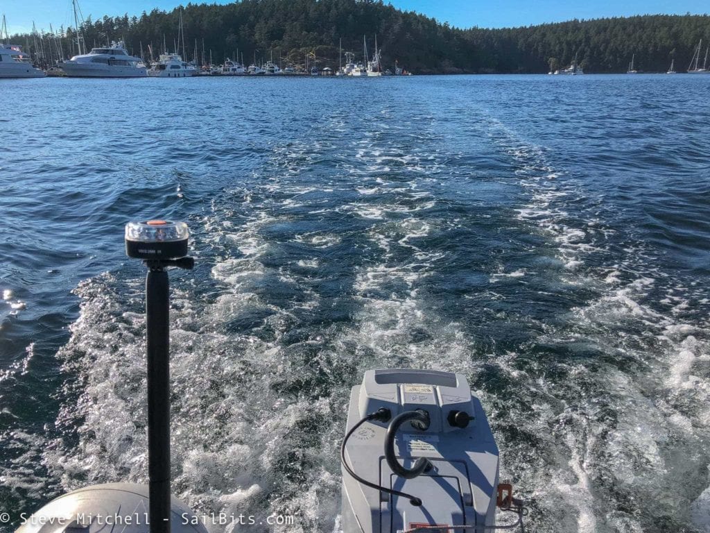
One of the products I have been playing with and will write about more is the Navisafe dinghy light kit, which I have been enjoying. You can get various versions of the kits which include battery powered lights that can be mounted to your dinghy in various ways. They are bright, and configurable – you can change which parts of the circular light are powered on, thereby allowing you to have an all around light, red+green, red only, etc. Very cool product! Here you can see the all around white light on the stern of my dinghy.
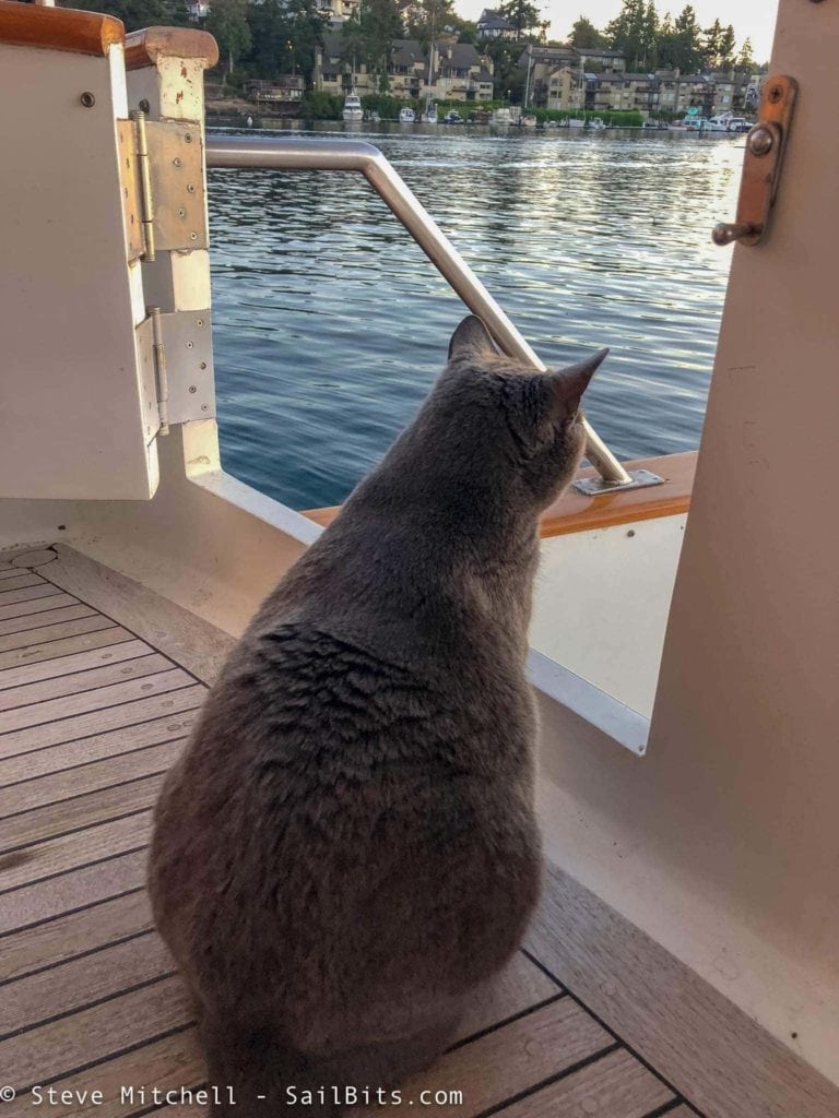
Isabelle absolutely loved being on Sea Bear – she had a constantly changing view of the world, and tons of places to inspect it from.
Time for one last cocktail and dinner aboard Sea Bear. It was bittersweet as we had been together for 13 days by now and had shared so many wonderful experiences together, each of us being apart during the day while underway, and sharing late evenings discussing everything from the trip earlier in the day to obscure scientific discoveries.
Regardless of how sad it was for the trip to end, I was so glad that I had participated in the trek to Princess Louisa Inlet. Not only was it something I have always wanted to do, but this trip re-energized my desire to cruise even more and longer distances. It really was a pivotal changing point for me and my future on the water.
Resting a Day in Friday Harbor
The forecast in the Strait of Juan de Fuca did not look great for the next day, so instead of leaving when I planned, I decided to stay another day in Friday Harbor.
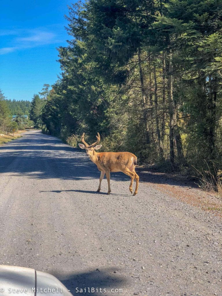
That day consisted of errands, provisioning, visiting Steve Roberts lab, a deer, and other randomness. I also spent some time cleaning up Grace as she had been underway for 15 non-stop days with no rest, and I had not had the water or the time to clean her decks – and they were super salty after all of the waves and wind!
I also spent some time geeking out with Steve on Datawake and talking about his upcoming re-power and other projects that we had both been energized to do as a result of this trip!
Foggy Strait
After a slow loop around the anchored Sea Bear and goodbyes to captain Holly, I headed out towards the Strait, still hearing that there was dense fog but hoping it would burn off.
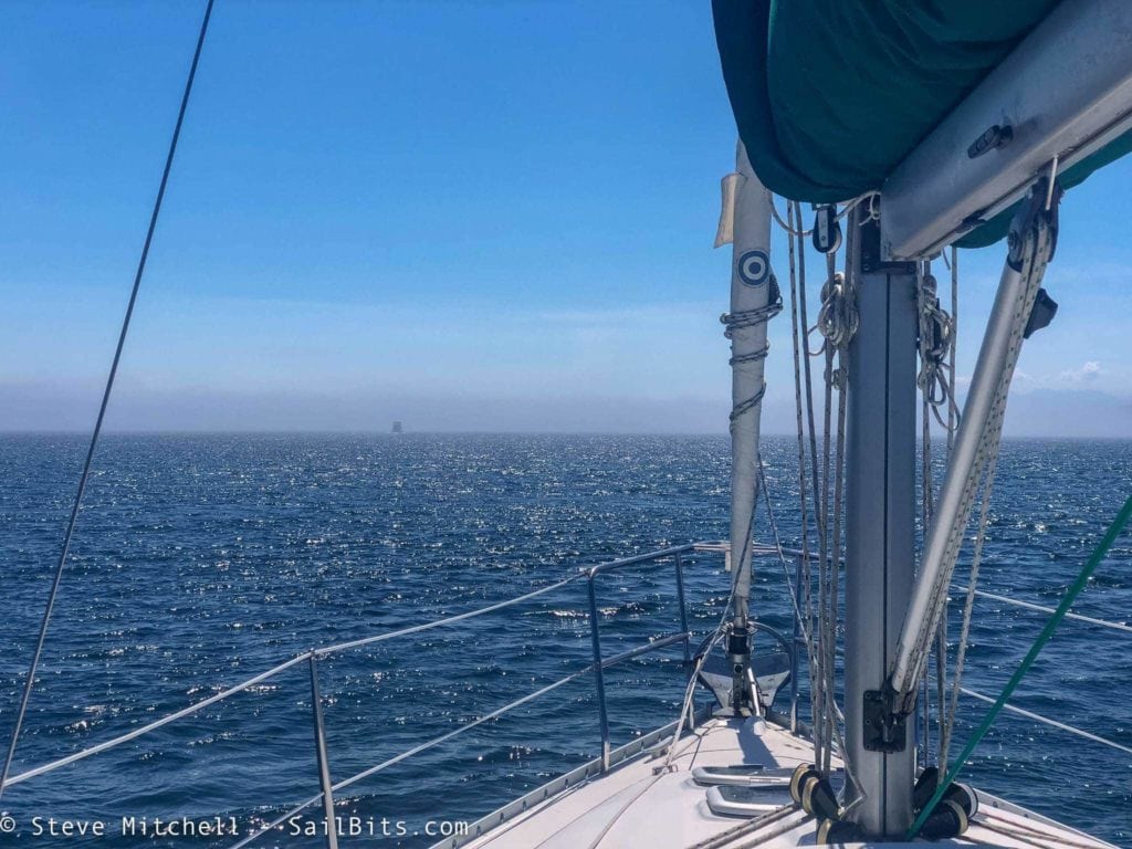
As I approached Cattle Pass, a thick wall of fog obscured the entire pass. I had my Raymarine radar all tuned up and ready, and AIS was working well.
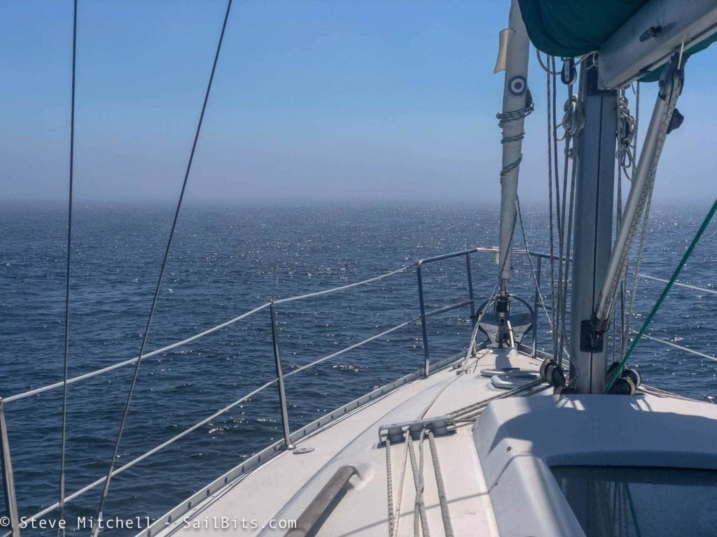
As I got closer, it got thicker. At this point I could probably see 1/2 NM but most of that was just shadows of boats coming towards me through the pass.
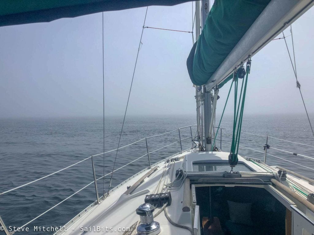
By the time I got into the beginning part of the pass, I could see less than 1/4 NM. The radar was absolutely required at this point. AIS helped for those that had it, but four large boats came through the pass at 10+ knots that didn’t have AIS. None of them made VHF calls, and all were going far too fast for the visibility we had. This was some of the most dense fog I had been in for a while – I’d been in Rosario a couple of years ago with worse, but it still wasn’t fun. It lasted for a good hour plus until I got away from the islands.
A boat behind me called me on VHF as they’d seen me on AIS, but they had no radar. They came through behind me – I don’t know if I would have been comfortable with that without the radar!
The fog dissipated, and I threw up the sails and headed for Pt. Hudson, where I had reservations for the night. There was still quite a bit of fog over near Pt. Angeles, but it wasn’t going to affect me.
The wind came up right after coming around Pt. Wells, and I had an embarrassing docking experience at Pt. Hudson. I can’t think of anywhere else where I have had more docking gaffes than here – the wind always comes up from the wrong direction right as I’m making my turn into the slip, just like it did today. A 20 knot gust caught me, and I had people running down the dock to grab my lines, while I pushed off my neighbors boat to keep it safe.
The sunset was wonderful, dinner was filet mignon on the BBQ, and all was well.
Back to Seattle
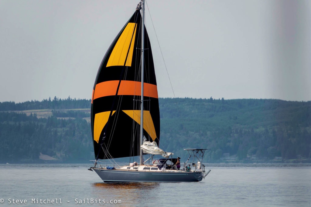
I was up moderately early, and out into Admiralty Inlet headed down towards Foulweather Bluff. The tides were in my favor in the morning, and I made good time down the channel. There was little wind to speak of, although this beautiful sailboat made the most of it with their spinnaker.
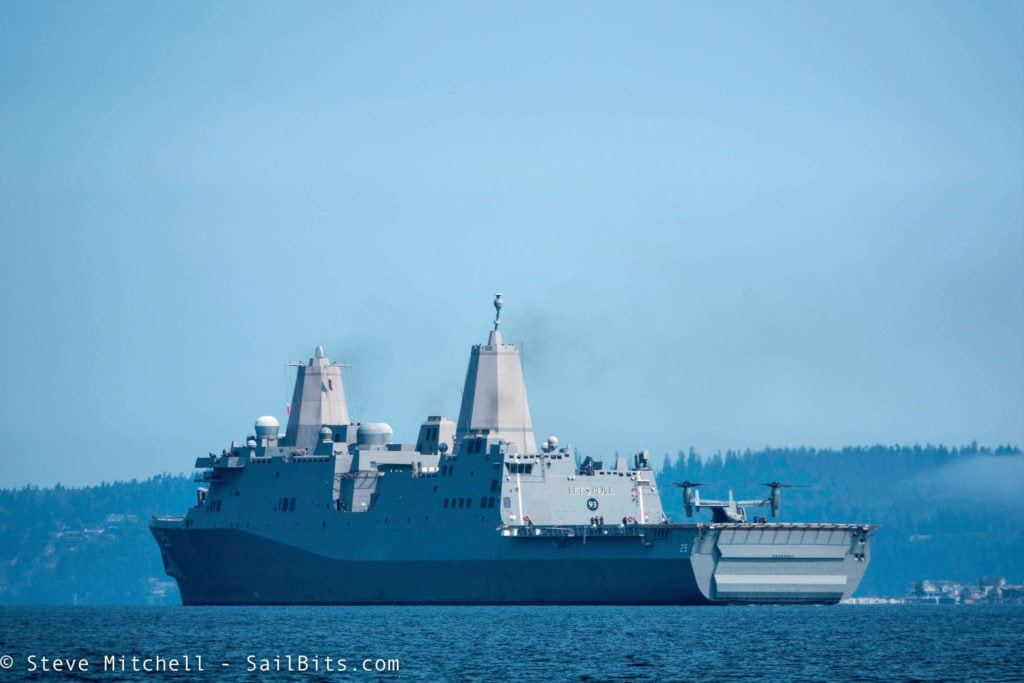
Seattle’s annual festival Seafair had just wrapped up along with Fleet Week, and up the channel came a number of warships that passed by. I particularly liked this more modern ship which is the USS Somerset (LPD-25), a San Antonio-class amphibious transport dock ship. The Osprey on the stern deck was pretty neat to see as well.
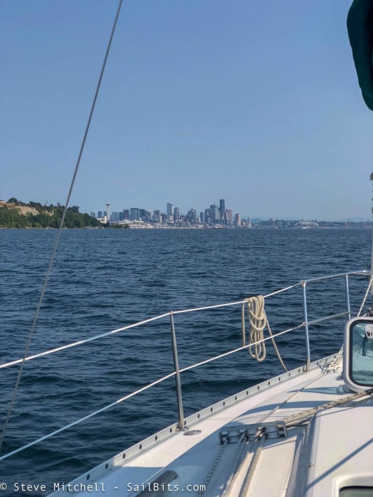
The rest of the journey was pretty uneventful – not much wind or waves, no drama, and the usual spots along the way south.
I arrived back at Elliott Bay Marina and Josh met me at the dock to catch my lines. After unloading a ton of stuff, and closing Grace up, I was sad to be leaving!
Thoughts
This trip was very pivotal for me on a number of levels.
I realized that while working on projects is my top passion, the reason to do those projects is so you can enjoy yourself on the water, go further, and experience more. Sometimes you can forget that, and I need to spend more time doing longer trips.
Grace’s performance really pleased me. I motored for the majority of the trip, and the new prop I installed earlier in the year made the journey much more comfortable. Combine that with the LiFePO4 battery bank, solar panels, and better alternator system, and I was able to stay on anchor longer, worry less about power, and use my Nespresso machine every day for quality coffee! The ultimate test was crossing the Strait of Georgia and her performance both directions, both while under sail. At no point was I worried about her abilities to get me across safely, and as you read above, the last crossing was not an easy one.
This trip also showed me that I should spend a lot more time in the Gulf Islands. I had not visited them in years, and even when I did it was only one or two places. There are a ton of anchorages and marinas that I look forward to visiting – and so close to my home cruising grounds!
The other big change I wrote about in Sailing towards Power – this trip was a turning point for the platform that I use on the water. I have always loved sailing, but the work and projects I do on board, and the places I want to go lend themselves far more to a power boat than a sailboat. The electronics and instruments that I want to test and experiment with are far too much to jam on a sailboat, and continue to try to do longer trips with 2 or more additional guests.
A lot of new ideas, new perspectives, and changes as a result of this trip. I absolutely loved it, and look forward to even more adventures in the future!
You can read Part 1 – Getting to Pender Harbour from Seattle and Part 2 – Princess Louisa Inlet if you missed those parts of the journey.
Archived Comments
These are read only comments from the old system. Scroll down to participate in SeaBits Discussions, our new interactive forum attached to each article.
Bruce
October 4, 2018 at 12:07 am
It’s funny, I’ve crossed the Strait half a dozen time in conditions like that (or close to it) and every time thanked my lucky stars we were on a sailboat. It’s probably the biggest reason not to move to power…and your trip ends up convincing you to switch. Lol.
Where was your dinghy on the crossing? We discovered this spring that ours becomes airborne around the 32 knot range and its a heavy, fiberglass-hulled model. I would think the inflatable hull would be a great big kite in the high 20s.
Enjoyed travelling along with you!
Val Vechnyak
October 4, 2018 at 12:55 am
Glad all ended well. I read somewhere cats and dogs feel motion sickness the same as humans. Maybe the cat felt better outside.
Quick question: What instrument/device produces this nice data recording?
- Steve Mitchell
October 3, 2018 at 6:50 pm
Hi Val,
Good point on the cat being outside, hadn’t thought of that. I generally feel better outside myself with the wind and being able to see the horizon well.
The data recorder is something I wrote about here: https://sailbits.com/yacht-devices-voyage-recorder-black-box-boat/ It’s made by Yacht Devices, and has been a wonderful addition to the boat that I don’t have to think about. Whenever I’m done with a long trip, just pull the SD card out, pop it in my computer, and start looking through the data. You can have it summarize it, as you saw in this article, in a spreadsheet, or export GPX or KML so you can import into Google Maps (also in this article).